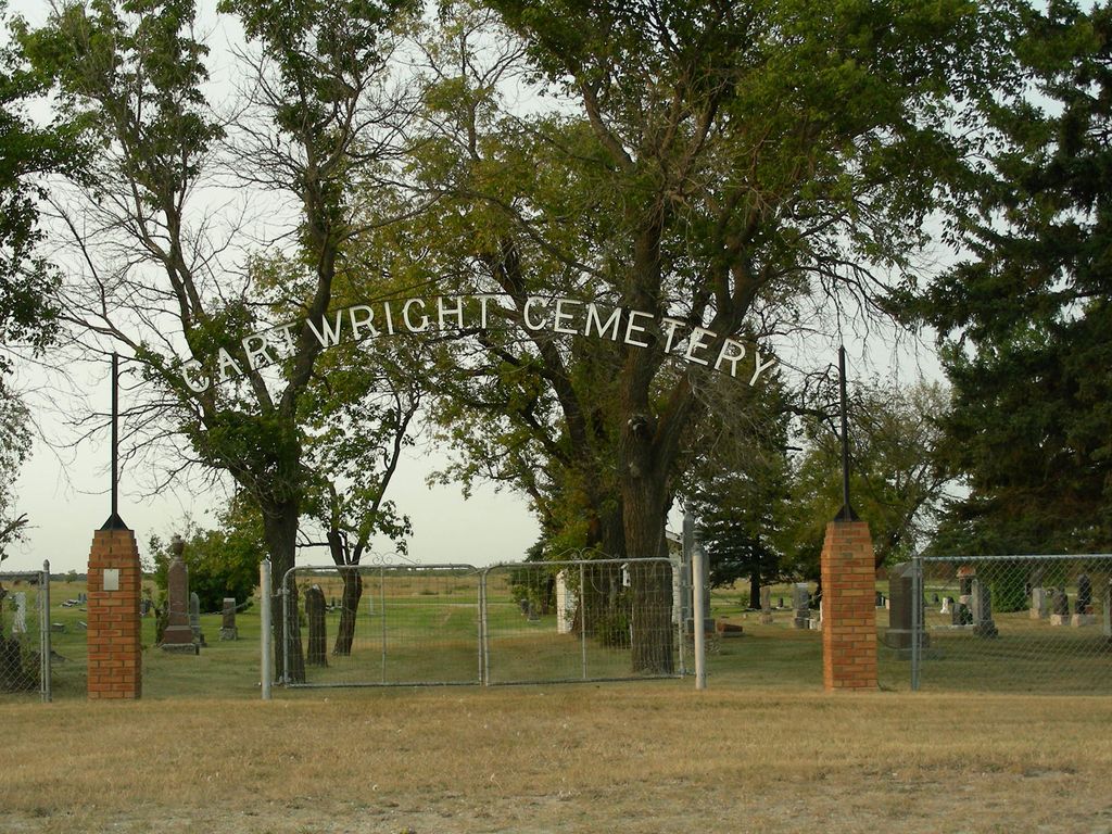
Cartwright Cemetery
Cartwright, Pilot Mound Census Division, Manitoba, Canada
About
-
Get directions 83490 Provincial Range Road 7N
Cartwright, RM of Cartwright-Roblin, Manitoba
R0K 0L0 CanadaCoordinates: 49.10428, -99.33397 - cartwrightroblin.com/p/cemeteries-
- [email protected]
- +1-204-529-2363
-
Office Address
RM of Cartwright-Roblin Office
485 Curwen St.
Cartwright, RM of Cartwright-Roblin, Manitoba
R0K 0L0 Canada - Cemetery ID:
-
Additional information
Located northeast of the town of Cartwright, MB, on the north side of Provincial Range Road 7N, where it meets Broadway
There is a limited network of roadways providing vehicular access to the grounds.
For queries about burials in this cemetery, the current caretakers of the site can be reached using the information on the RM of Cartwright-Roblin website
Members have Contributed
Advertisement
Photos
No additional photos.
Add PhotosSouthwestern Manitoba was opened to immigration in the late 1870s after the Boundary Commission completed a survey along the 49th parallel which separates Canada from the United States. The first immigrants were from eastern Canada, mostly of British or Irish descent, and arrived on their homesteads as early as the summer of 1879.
The town of Cartwright was established in 1885 along the newly built CP railway. As a convenience to the public in the early days of the community, Mr. John Wallace permitted the use of a knoll in his cow pasture on the NW-6-2-14(-W1) as a burying ground. In 1900, however, a cemetery committee consisting of local clergy and citizens was established to purchase land for a permanent cemetery. The first plots of the new Cartwright Cemetery were advertised for sale in June 1900. The first burial in the new cemetery occurred in August of 1900, that of baby Margaret Isabella Preston, daughter of the local jeweller.
Most of the individuals interred on the original burying grounds were transferred to Cartwright Cemetery shortly after it opened. However, thirty interments remained in the original burying ground until 1962 when they were relocated to make way for a highway improvement. Two plots (342 and 365) in the Cartwright Cemetery were purchased by the Manitoba Department of Highways for these reinterments and a cairn was dedicated to the pioneers of the Cartwright district. Only 13 of the reinterred individuals were identified, leaving 17 unknown burials (9 adults, 8 children) in these plots.
Ownership of the cemetery was transferred to the local municipality in 1906.
(Source: Memories Along the Badger Revisited - Cartwright and District 1885 - 1985, especially from pp 70f [Adapted])
Dominion Land Survey coordinates: LSD02-07-02-14-W1
In the Rural Municipality of Cartwright-Roblin
A part of the town's story and those of its inhabitants from the early days of European settlement through roughly 2010 is told in the volumes "Memories Along the Badger Revisited - Cartwright and District 1885 - 1985", especially starting on page 70 and "Memories Along the Badger Continued Cartwright and District 1985 - 2010".
Free digital versions of these and many other Manitoba local history books can be found online in the University of Manitoba Digital Collections. There is also a list of such books organized by district and town name on the Manitoba Historical Society's website on their page entitled "Finding Aid: Manitoba Local History Books".
A list of burials in this cemetery is available from the Manitoba Genealogical Society (reference #0728), transcribed by a member or members in 1992. Also available to MGS members is a searchable online database named the "MGS Manitoba Name Index" (or MANI). Some additional information is contained in the 1996 MGS publication "Carved in Stone: Manitoba Cemeteries and Burial Sites" (revised edition, Special Projects Publication, 106 pages).
Southwestern Manitoba was opened to immigration in the late 1870s after the Boundary Commission completed a survey along the 49th parallel which separates Canada from the United States. The first immigrants were from eastern Canada, mostly of British or Irish descent, and arrived on their homesteads as early as the summer of 1879.
The town of Cartwright was established in 1885 along the newly built CP railway. As a convenience to the public in the early days of the community, Mr. John Wallace permitted the use of a knoll in his cow pasture on the NW-6-2-14(-W1) as a burying ground. In 1900, however, a cemetery committee consisting of local clergy and citizens was established to purchase land for a permanent cemetery. The first plots of the new Cartwright Cemetery were advertised for sale in June 1900. The first burial in the new cemetery occurred in August of 1900, that of baby Margaret Isabella Preston, daughter of the local jeweller.
Most of the individuals interred on the original burying grounds were transferred to Cartwright Cemetery shortly after it opened. However, thirty interments remained in the original burying ground until 1962 when they were relocated to make way for a highway improvement. Two plots (342 and 365) in the Cartwright Cemetery were purchased by the Manitoba Department of Highways for these reinterments and a cairn was dedicated to the pioneers of the Cartwright district. Only 13 of the reinterred individuals were identified, leaving 17 unknown burials (9 adults, 8 children) in these plots.
Ownership of the cemetery was transferred to the local municipality in 1906.
(Source: Memories Along the Badger Revisited - Cartwright and District 1885 - 1985, especially from pp 70f [Adapted])
Dominion Land Survey coordinates: LSD02-07-02-14-W1
In the Rural Municipality of Cartwright-Roblin
A part of the town's story and those of its inhabitants from the early days of European settlement through roughly 2010 is told in the volumes "Memories Along the Badger Revisited - Cartwright and District 1885 - 1985", especially starting on page 70 and "Memories Along the Badger Continued Cartwright and District 1985 - 2010".
Free digital versions of these and many other Manitoba local history books can be found online in the University of Manitoba Digital Collections. There is also a list of such books organized by district and town name on the Manitoba Historical Society's website on their page entitled "Finding Aid: Manitoba Local History Books".
A list of burials in this cemetery is available from the Manitoba Genealogical Society (reference #0728), transcribed by a member or members in 1992. Also available to MGS members is a searchable online database named the "MGS Manitoba Name Index" (or MANI). Some additional information is contained in the 1996 MGS publication "Carved in Stone: Manitoba Cemeteries and Burial Sites" (revised edition, Special Projects Publication, 106 pages).
Nearby cemeteries
Cartwright, Pilot Mound Census Division, Manitoba, Canada
- Total memorials2
- Percent photographed0%

Cartwright, Pilot Mound Census Division, Manitoba, Canada
- Total memorials1
- Percent photographed100%
- Percent with GPS0%

Mather, Pilot Mound Census Division, Manitoba, Canada
- Total memorials516
- Percent photographed98%
- Percent with GPS0%

Holmfield, Southwestern Census Division, Manitoba, Canada
- Total memorials378
- Percent photographed94%
- Percent with GPS3%
- Added: 11 Feb 2012
- Find a Grave Cemetery ID: 2437111

Cemetery Photos
This is a carousel with slides. Use Next and Previous buttons to navigate, or jump to a slide with the slide dots. Use Escape keyboard button or the Close button to close the carousel.
Success
Uploading...
Waiting...
Failed
This photo was not uploaded because this cemetery already has 20 photos
This photo was not uploaded because you have already uploaded 5 photos to this cemetery
This photo was not uploaded because you have already uploaded 5 photos to this cemetery
Invalid File Type
Birth and death years unknown.
1 photo picked...
2 photos picked...
Uploading 1 Photo
Uploading 2 Photos
1 Photo Uploaded
2 Photos Uploaded
Size exceeded
Too many photos have been uploaded
"Unsupported file type"
• ##count## of 0 memorials with GPS displayed. Double click on map to view more.No cemeteries found