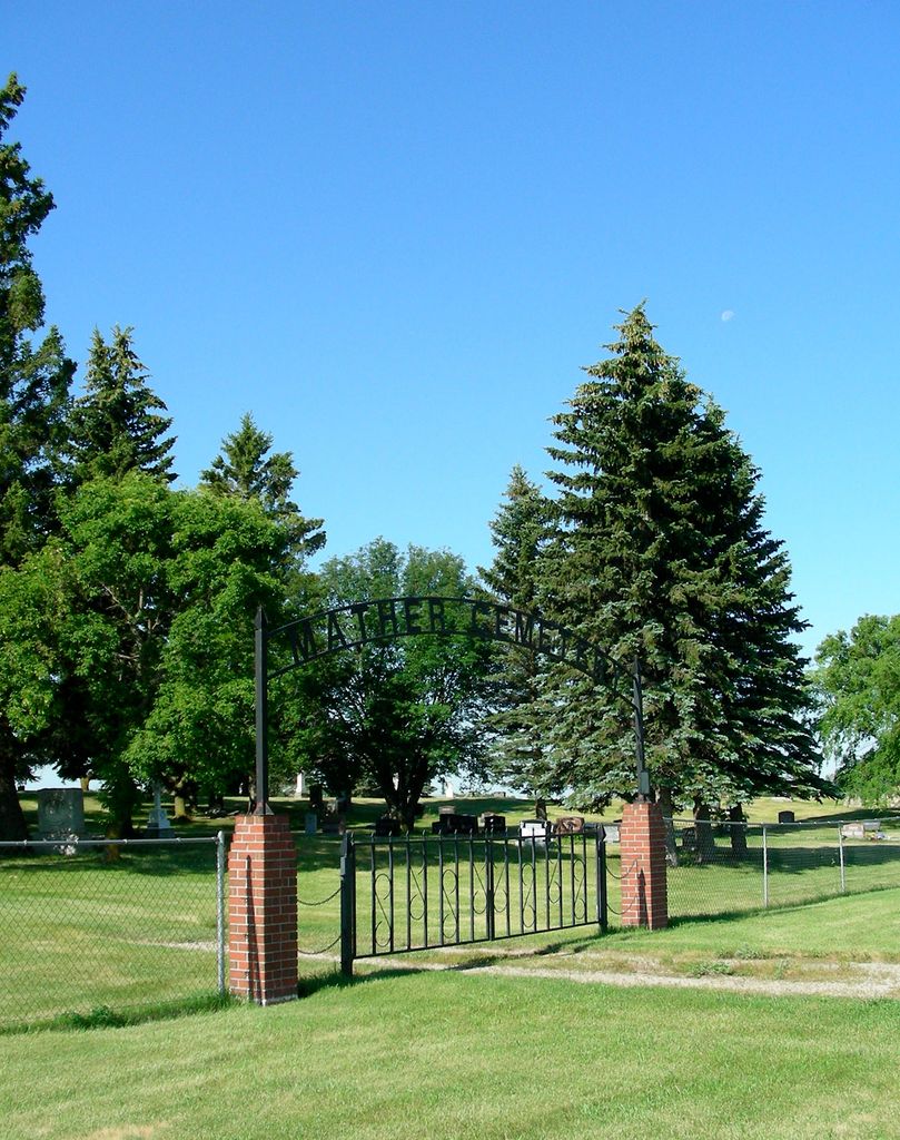
Mather Cemetery
Mather, Pilot Mound Census Division, Manitoba, Canada
About
-
Get directions 76650 Provincial Range Road 7N
Mather, RM of Cartwright-Roblin, Manitoba
R0K 1L0 CanadaCoordinates: 49.10312, -99.18217 - cartwrightroblin.com/p/cemeteries-
- [email protected]
- +1-204-529-2363
-
Office Address
RM of Cartwright-Roblin Office
485 Curwen St.
Cartwright, RM of Cartwright-Roblin, Manitoba
R0K 0L0 Canada - Cemetery ID:
-
Additional information
Located NW of the town site of Mather, MB, about 0.5. miles east of Provincial Road 442, on the south side of Provincial Range Road 7N
There is no network of roadways providing vehicular access to the grounds.
For queries about burials in this cemetery, the current caretakers of the site can be reached using the information on the RM of Cartwright-Roblin website
Members have Contributed
Advertisement
Photos
No additional photos.
Add PhotosThe first burials recorded in Mather Cemetery were in 1904. The Municipal Council paid for the land in 1905. On November 21, 1905 the Roblin Council passed an order to pay Wm. Gordon for four acres of NW-5-2-13(-W1). The clerk was George Way, the Reeve was D. B. McKinnon. This land was to be Mather Cemetery.
Orange Howard was the first groundskeeper. Others were Wes Howard, Ab Fulford, Frank Baudic Sr., Jack Lloyd, and the (then) present groundskeeper, Earl Howard.
It is a lesson in Mather history itself to walk through the cemetery and see the names of our early pioneers, and the names of our present families, recorded there.
(Source: Crocus Country - A History of Mather & Surrounding Districts, p 21 [Adapted])
Dominion Land Survey coordinates: LSD15-05-02-13-W1
In the Rural Municipality of Cartwright-Roblin
As noted above, a part of the town's story and those of its inhabitants from the early days of European settlement through roughly 1981 is told in the volume "Crocus Country - A History of Mather & Surrounding Districts", especially starting on page 21. A free digital version of this and many other Manitoba local history books can be found online in the University of Manitoba Digital Collections. There is also a list of such books organized by district and town name on the Manitoba Historical Society's website on their page entitled "Finding Aid: Manitoba Local History Books".
A list of burials in this cemetery is available from the Manitoba Genealogical Society (reference #0075), transcribed by a member or members in 1985. Also available to MGS members is a searchable online database named the "MGS Manitoba Name Index" (or MANI). Some additional information is contained in the 1996 MGS publication "Carved in Stone: Manitoba Cemeteries and Burial Sites" (revised edition, Special Projects Publication, 106 pages).
The first burials recorded in Mather Cemetery were in 1904. The Municipal Council paid for the land in 1905. On November 21, 1905 the Roblin Council passed an order to pay Wm. Gordon for four acres of NW-5-2-13(-W1). The clerk was George Way, the Reeve was D. B. McKinnon. This land was to be Mather Cemetery.
Orange Howard was the first groundskeeper. Others were Wes Howard, Ab Fulford, Frank Baudic Sr., Jack Lloyd, and the (then) present groundskeeper, Earl Howard.
It is a lesson in Mather history itself to walk through the cemetery and see the names of our early pioneers, and the names of our present families, recorded there.
(Source: Crocus Country - A History of Mather & Surrounding Districts, p 21 [Adapted])
Dominion Land Survey coordinates: LSD15-05-02-13-W1
In the Rural Municipality of Cartwright-Roblin
As noted above, a part of the town's story and those of its inhabitants from the early days of European settlement through roughly 1981 is told in the volume "Crocus Country - A History of Mather & Surrounding Districts", especially starting on page 21. A free digital version of this and many other Manitoba local history books can be found online in the University of Manitoba Digital Collections. There is also a list of such books organized by district and town name on the Manitoba Historical Society's website on their page entitled "Finding Aid: Manitoba Local History Books".
A list of burials in this cemetery is available from the Manitoba Genealogical Society (reference #0075), transcribed by a member or members in 1985. Also available to MGS members is a searchable online database named the "MGS Manitoba Name Index" (or MANI). Some additional information is contained in the 1996 MGS publication "Carved in Stone: Manitoba Cemeteries and Burial Sites" (revised edition, Special Projects Publication, 106 pages).
Nearby cemeteries

Cartwright, Pilot Mound Census Division, Manitoba, Canada
- Total memorials1k+
- Percent photographed82%
- Percent with GPS1%
Cartwright, Pilot Mound Census Division, Manitoba, Canada
- Total memorials2
- Percent photographed0%

Cartwright, Pilot Mound Census Division, Manitoba, Canada
- Total memorials1
- Percent photographed100%
- Percent with GPS0%

Clearwater, Pilot Mound Census Division, Manitoba, Canada
- Total memorials527
- Percent photographed76%
- Percent with GPS2%
- Added: 17 Sep 2012
- Find a Grave Cemetery ID: 2465966

Cemetery Photos
This is a carousel with slides. Use Next and Previous buttons to navigate, or jump to a slide with the slide dots. Use Escape keyboard button or the Close button to close the carousel.
Success
Uploading...
Waiting...
Failed
This photo was not uploaded because this cemetery already has 20 photos
This photo was not uploaded because you have already uploaded 5 photos to this cemetery
This photo was not uploaded because you have already uploaded 5 photos to this cemetery
Invalid File Type
Birth and death years unknown.
1 photo picked...
2 photos picked...
Uploading 1 Photo
Uploading 2 Photos
1 Photo Uploaded
2 Photos Uploaded
Size exceeded
Too many photos have been uploaded
"Unsupported file type"
• ##count## of 0 memorials with GPS displayed. Double click on map to view more.No cemeteries found