Paupers Graveyard
Ballyshannon, County Donegal, Ireland
About
-
Get directions Bishop Street, Ballyshannon, Co. Donegal
Ballyshannon, County Donegal IrelandCoordinates: 54.50302, -8.19510 - Cemetery ID:
Members have Contributed
Advertisement
Photos


The hill on which the Graveyard is situated is called Mullaghnashee, which literally means "The Hill of Hugh of the faeries". This was said to have been the burial place of Aedh Ruadh, and a royal residence for Conal Gulban (died c464) , son of Niall of the Nine Hostages who gave his name to Tír Chonaill. Later still the hill was the site of a military fortification in 1798 which today is incorporated in the site of the graveyard.
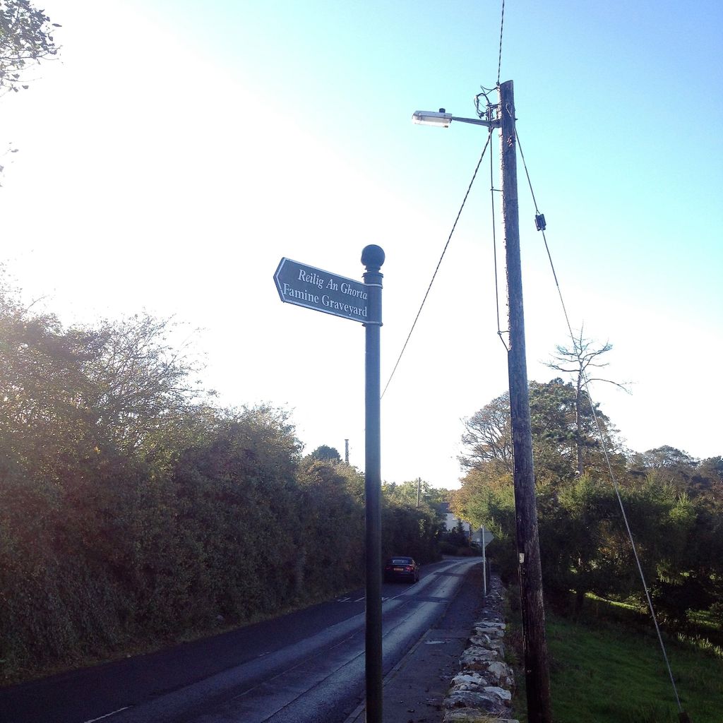
To get to the site from the centre of town, walk uphill up Main street, passing Dorrian's Hotel on your left. At the top of Main street turn left onto Bishop Street, with The Thatch Pub on the corner on your left. About 150-200m down Bishop Street you will see a sign indicating that the Paupers Graveyard is off the road on the left. There is an information notice at the entrance to the site. The site lies atop a small hill about 80m from the sign on the road. The site is directly to the west of St. Anne's Church of Ireland, but there is no access to the site directly from St. Anne's). The elevated position commands fine views of the surrounding countryside, mountains and sea. The walk from the Main Street takes 10 to 15 minutes.
Bishop Street leads eventually to Rossnowlagh.
The hill on which the Graveyard is situated is called Mullaghnashee, which literally means "The Hill of Hugh of the faeries". This was said to have been the burial place of Aedh Ruadh, and a royal residence for Conal Gulban (died c464) , son of Niall of the Nine Hostages who gave his name to Tír Chonaill. Later still the hill was the site of a military fortification in 1798 which today is incorporated in the site of the graveyard.
To get to the site from the centre of town, walk uphill up Main street, passing Dorrian's Hotel on your left. At the top of Main street turn left onto Bishop Street, with The Thatch Pub on the corner on your left. About 150-200m down Bishop Street you will see a sign indicating that the Paupers Graveyard is off the road on the left. There is an information notice at the entrance to the site. The site lies atop a small hill about 80m from the sign on the road. The site is directly to the west of St. Anne's Church of Ireland, but there is no access to the site directly from St. Anne's). The elevated position commands fine views of the surrounding countryside, mountains and sea. The walk from the Main Street takes 10 to 15 minutes.
Bishop Street leads eventually to Rossnowlagh.
Nearby cemeteries

Ballyshannon, County Donegal, Ireland
- Total memorials1k+
- Percent photographed61%
- Percent with GPS55%
Ballyshannon, County Donegal, Ireland
- Total memorials4
- Percent photographed100%
- Percent with GPS0%

Ballyshannon, County Donegal, Ireland
- Total memorials1k+
- Percent photographed21%
- Percent with GPS9%

Ballyshannon, County Donegal, Ireland
- Total memorials11
- Percent photographed18%
- Percent with GPS0%
- Added: 24 Oct 2018
- Find a Grave Cemetery ID: 2674952

Cemetery Photos
This is a carousel with slides. Use Next and Previous buttons to navigate, or jump to a slide with the slide dots. Use Escape keyboard button or the Close button to close the carousel.


Success
Uploading...
Waiting...
Failed
This photo was not uploaded because this cemetery already has 20 photos
This photo was not uploaded because you have already uploaded 5 photos to this cemetery
This photo was not uploaded because you have already uploaded 5 photos to this cemetery
Invalid File Type
Birth and death years unknown.
1 photo picked...
2 photos picked...
Uploading 1 Photo
Uploading 2 Photos
1 Photo Uploaded
2 Photos Uploaded
Size exceeded
Too many photos have been uploaded
"Unsupported file type"
• ##count## of 0 memorials with GPS displayed. Double click on map to view more.No cemeteries found