Owens Family Cemetery
Also known as Rev. David Owens Family Cemetery
Marion County, South Carolina, USA – *No GPS coordinates
About
-
No location information available
Add Location - Cemetery ID:
Members have Contributed
- 14 Memorials
- 7% photographed
- No location information available Add Location
Advertisement
Photos

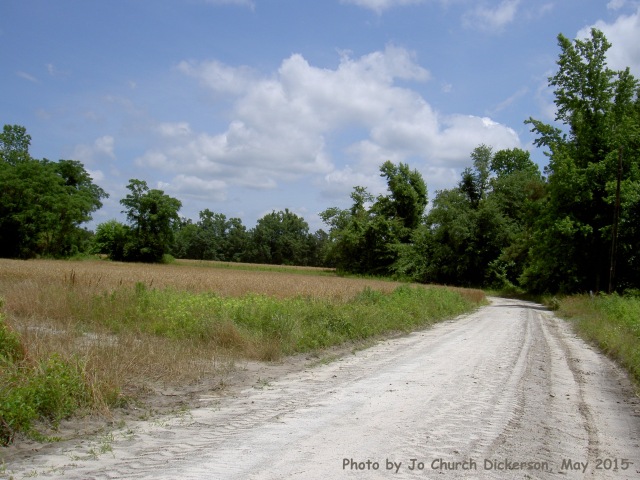
The photos on the right are NOT of the Owens Cemetery, rather, of the road that leads past Gapway Church and Cemetery to the Owens Cemetery. Please click on photos for more detail.
The precise location of the burial ground of Rev. David Owens' family is no longer known. It has been abandoned, overgrown, and lost to researchers for many years and the road no longer goes there. It was not included in the book, "One Hundred and One Cemeteries in Marion County, South Carolina" by the Marion County Historical Society, (1985).
It is believed that Rev. David Owens, one or more of his wives, children, and others of his family are buried here. It is said to be in nearly impenetrable overgrowth, with only one marker remaining - a tombstone marking the grave of one of Rev. David's great grandsons.
In his 1993 book on the Owens family history, Daniel K. Owens, a descendant of Rev. David Owens, wrote:
"Rev. David died in late June, 1804. His will is on file at the Marion Co. Probate Office. . . Rev. David is probably buried in the Owens Cemetery in the woods at the end of the dirt road running in front of Gapway Church. The cemetery has gone to ruin. The only gravestone there is that of Edward Lide Owens. That stone and many depressions in the ground are all that is left to mark the resting place of our ancestors." (Excerpt from page 14, "Descendants of the Rev. David Owens" by Daniel K. Owens, published by the Pee Dee Chapter, South Carolina Genealogical Society, 2nd Edition, 1993.)
The cemetery is in what is now a wooded area somewhere in the vicinity of the end of the dirt road that runs through the Gapway Church Cemetery; the road on which Gapway Church faces. Documents, including his will and a deed and plat for his son, Solomon Owens, make it clear that Rev. David Owens resided on the same lands where the Owens Family Cemetery is located, and is almost certainly buried there.
This historical cemetery that is so connected to the early history of Marion County is in or near the path of the proposed Interstate 73 (I-73) corridor. (See maps, database, etc. for the project at the SCDOT Website, and on file at the Marion County Archives & History Center in Marion. It is included in a study of cemeteries in the path of I-73 that was published in the November-December 2006 issue of the Pee Dee Queue, newsletter of the Pee Dee Chapter, South Carolina Genealogical Society, and available from the Marion County Archives and History Center.)
History of the cemetery land
Both Gapway Baptist Church - founded by Rev. David Owens about 1795 - and the old Owens family cemetery are on a 1000 acre tract that was surveyed for Jordan Roche of Charleston in 1736 and granted to Roche in 1737. The land bounded to the north on Meredith Atkinson, and to the south on Mrs. Elizabeth Bremar. (South Carolina Colonial Plats vol. 3, page 258; South Carolina Colonial Land Grants vol. 3 page 53, available online at the South Carolina Archives and History Center Online Index.)
There is no record of conveyance of this tract by Roche to anyone, but in 1790 Thomas Snead, conveyed 750 acres of that same land to Rev. David Owens, the deed stating it had been granted to Snead in 1786. This was a case of a more recent grant (called a "junior grant") of previously granted land, often because the older grant lay dormant, or was purchased but the deed lost or otherwise not recorded, so a grant was sought to obtain clear title. Snead's deed to Owens stated Snead's land bounded northward on Atkinson's land and southward on Bremar's land. (The source for this deed is the Owens family history by Danny Owens, cited above, on page 102, Appendix 8, "Deed - Thomas Snead to David Owens". The deed was recorded in Georgetown District in 1790. Those records were destroyed during the Civil War, but the original deed was still in private hands when Danny had access to and transcribed the full text for his book.)
Using DeedMapper plat drawing software, it has been possible to lay out the approximate locations of these various tracts using landmarks and waterways.
Bremar's two tracts of 1000 acres each bounded immediately to the south of Roche. Roche and Bremar's common boundary line reached the river near Sandy Bluff Bridge at Sandy Bluff Landing (shown on at least one old map as Owens Landing). These two tracts were granted in the 1730s to Mrs. Elizabeth Bremar of Charleston, and conveyed to Rev. David Owens in 1802 by her son or grandson, Francis Bremar, also of Charleston. (Marion County Deed Book B page 134.) The Bremar tracts lay south of Gapway Church, and parts were conveyed by Rev. David to his son, William, and to others in his family.
The Roche/Snead tract covered the lands on which Gapway Church was built and where the present church and cemetery are located; the area around the end of the dirt road; and down across the Back Swamp to Little Pee Dee River. Thus the old Owens Family Cemetery would seem to be located on this tract.
In his will dated in June 1804, Rev. David Owens gave to his youngest son Solomon 750 acres of land. That appears to have been the entire Roche/Snead tract that Snead had conveyed to Owens in 1790. It included the land David lived on (according to David's will), which, after the death of David's widow, was also to go to Solomon. (Will of Rev. David Owens, Appendix 9 page 104, transcribed in the Owens Family History.)
In 1837 Solomon conveyed 540 acres of this tract by a Deed of Gift to his son, A.D.G. Owens. The deed does not mention the cemetery, but an accompanying plat shows the Meeting House (Gapway), Adams Hole Branch which runs past the Meeting House, and lands stretching from the church to Little Pee Dee River. The Owens Family Cemetery would have been on this or an adjacent piece of land. (Uncited deed of Solomon Owens to his son A.D.G. Owens in the Owens Family History, Appendix 6 page 99.)
So it seems likely that the cemetery descended in the possession of the Solomon Owens family. And indeed, Danny Owens stated unequivocally in his book that Solomon was buried at the family cemetery.
--------------
This Findagrave cemetery page for the Owens Family Cemetery was created by Jo Church Dickerson, May 2015. Information on the family history is primarily based on the Owens family history by Danny K. Owens, cited above. Information and analysis of the land records and ownership of lands in this area at varying times is based on my own personal research in the records of Marion County, South Carolina, and records at the South Carolina Department of Archives and History, and the land records included by Daniel K. Owens in his Owens family history.
Nearby cemeteries

Marion, Marion County, South Carolina, USA
- Total memorials3k+
- Percent photographed92%
- Percent with GPS6%

Mullins, Marion County, South Carolina, USA
- Total memorials2k+
- Percent photographed93%
- Percent with GPS6%

Mullins, Marion County, South Carolina, USA
- Total memorials1k+
- Percent photographed78%
- Percent with GPS9%

Brittons Neck, Marion County, South Carolina, USA
- Total memorials1k+
- Percent photographed84%
- Percent with GPS39%
- Added: 23 May 2015
- Find a Grave Cemetery ID: 2579702

Cemetery Photos
This is a carousel with slides. Use Next and Previous buttons to navigate, or jump to a slide with the slide dots. Use Escape keyboard button or the Close button to close the carousel.

Success
Uploading...
Waiting...
Failed
This photo was not uploaded because this cemetery already has 20 photos
This photo was not uploaded because you have already uploaded 5 photos to this cemetery
This photo was not uploaded because you have already uploaded 5 photos to this cemetery
Invalid File Type
Birth and death years unknown.
1 photo picked...
2 photos picked...
Uploading 1 Photo
Uploading 2 Photos
1 Photo Uploaded
2 Photos Uploaded
Size exceeded
Too many photos have been uploaded
"Unsupported file type"
• ##count## of 0 memorials with GPS displayed. Double click on map to view more.No cemeteries found