Gilman-Sargent Campground Cemetery
Potton, Estrie Region, Quebec, Canada
About
-
Get directions Across from 2748 Chemin de la Vallée Missisquoi (Judd Residence)
Potton, Estrie Region, Quebec J0E 1X0 CanadaCoordinates: 45.03175, -72.43741 - Cemetery ID:
Members have Contributed
Advertisement
Photos
No additional photos.
Add Photos_______________________________________________________
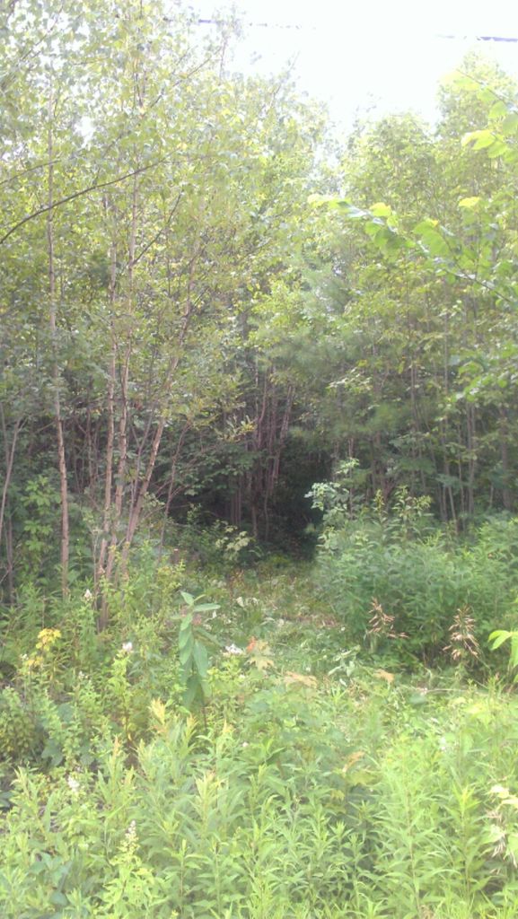
This was an abandoned and overgrown cemetery on chemin de la Vallée Missisquoi next to the Carrefour des Campeurs Campground. Restoration of the cemetery began in July 2013. More details will be added.
While recently working in the cemetery, local resident John Aiken stopped to look at progress. He stated that when he was a boy, the land that the cemetery sits on was part of "the Sargent farm," and that the cemetery was not overgrown. The Sargent family used to have their cows graze the cemetery as apparently was a common practice in this area at that time. The Sargents had family buried in this cemetery.
Former Mansonville & Dunkin Postmaster Kenneth Jones had this to say about the cemetery: "...the 'Gilman' so called for being situated near the establishment of Dr. Gilman and his father, Thomas Gilman, who came to Potton about the year 1800. There are probably seventy-five or more bodies mouldering in the dust where good intentions have been overtaken by procrastination... The Gilman Stones have been brought up to Mansonville... "
The oldest burial listed is an infant in 1819.
The most recent burial listed is 1931.
There were just a handful of 20th-Century graves.
Information mentioned in comments has come from these sources:
JC = John Cogan
KJ = Kenneth Jones, Former Mansonville & Potton Postmaster
PD = Peter Downman, Historian of Mansonville Area
MS = Marlene Simmons & Paul Jennings, Genealogists
JC = Joan Cruickshank, Genealogist
MD = Marilyn Davis & Marjorie-Anne Smith, Genealogists
SJ = Sandra Jewett, Historian & President of PHA
LML = Legion Memorial Library/Bibliothèque de Mansonville
PHA = Potton Heritage Assn/Association du patrimoine de Potton
BCH = Brome Co. Hist. Soc./Société Historique du Comté de Brome
_______________________________________________________
This was an abandoned and overgrown cemetery on chemin de la Vallée Missisquoi next to the Carrefour des Campeurs Campground. Restoration of the cemetery began in July 2013. More details will be added.
While recently working in the cemetery, local resident John Aiken stopped to look at progress. He stated that when he was a boy, the land that the cemetery sits on was part of "the Sargent farm," and that the cemetery was not overgrown. The Sargent family used to have their cows graze the cemetery as apparently was a common practice in this area at that time. The Sargents had family buried in this cemetery.
Former Mansonville & Dunkin Postmaster Kenneth Jones had this to say about the cemetery: "...the 'Gilman' so called for being situated near the establishment of Dr. Gilman and his father, Thomas Gilman, who came to Potton about the year 1800. There are probably seventy-five or more bodies mouldering in the dust where good intentions have been overtaken by procrastination... The Gilman Stones have been brought up to Mansonville... "
The oldest burial listed is an infant in 1819.
The most recent burial listed is 1931.
There were just a handful of 20th-Century graves.
Information mentioned in comments has come from these sources:
JC = John Cogan
KJ = Kenneth Jones, Former Mansonville & Potton Postmaster
PD = Peter Downman, Historian of Mansonville Area
MS = Marlene Simmons & Paul Jennings, Genealogists
JC = Joan Cruickshank, Genealogist
MD = Marilyn Davis & Marjorie-Anne Smith, Genealogists
SJ = Sandra Jewett, Historian & President of PHA
LML = Legion Memorial Library/Bibliothèque de Mansonville
PHA = Potton Heritage Assn/Association du patrimoine de Potton
BCH = Brome Co. Hist. Soc./Société Historique du Comté de Brome
Nearby cemeteries

Mansonville, Estrie Region, Quebec, Canada
- Total memorials19
- Percent photographed95%
- Percent with GPS95%

Mansonville, Estrie Region, Quebec, Canada
- Total memorials3
- Percent photographed100%
- Percent with GPS33%

Mansonville, Estrie Region, Quebec, Canada
- Total memorials195
- Percent photographed95%
- Percent with GPS82%

Dunkin, Estrie Region, Quebec, Canada
- Total memorials376
- Percent photographed89%
- Percent with GPS7%
- Added: 27 Jul 2013
- Find a Grave Cemetery ID: 2505891

Cemetery Photos
This is a carousel with slides. Use Next and Previous buttons to navigate, or jump to a slide with the slide dots. Use Escape keyboard button or the Close button to close the carousel.
Success
Uploading...
Waiting...
Failed
This photo was not uploaded because this cemetery already has 20 photos
This photo was not uploaded because you have already uploaded 5 photos to this cemetery
This photo was not uploaded because you have already uploaded 5 photos to this cemetery
Invalid File Type
Birth and death years unknown.
1 photo picked...
2 photos picked...
Uploading 1 Photo
Uploading 2 Photos
1 Photo Uploaded
2 Photos Uploaded
Size exceeded
Too many photos have been uploaded
"Unsupported file type"
• ##count## of 0 memorials with GPS displayed. Double click on map to view more.No cemeteries found