Poe Cemetery
Also known as Allen Cemetery
Sweet Springs, Saline County, Missouri, USA
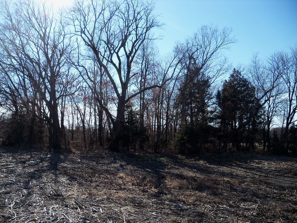
The cemetery is not maintained, and is overgrown in brush, vines and trees.
It appears that there has not been a burial there for several decades. (description entered 01/16/2012)
The cemetery is 4.9 miles north northeast of Sweet Springs, 4.1 miles north northwest of Emma, 5.6 miles south of Blackburn, 3.4 miles south southwest of Elmwood, and is probably most easily accessed from the Emma north exit on Interstate 70. James G. Beattie was first owner of the cemetery property, obtaining a land patent on November 10, 1841. The land was the East half of the Northwest quarter of Section 20 in Township 49, Range 23. James Gilmore Beattie was buried in his cemetery in 1874. Other Beattie family members obtained land patents in the same area. The cemetery was first known as the Beattie family cemetery. The 1876 county plat map shows the cemetery with land ownership by B(enjamin). T. Poe with Beatties as neighbors. The 1896 county plat map marks the cemetery and shows the land under different ownership, with J. H. Poe as nearest resident, marking a house in Section 20 northeast of cemetery.
In the early part of the 20th century, death certificates listed the cemetery name as Poe. Later it was designated Allen Cemetery by the U.S. Geological Survey, named for a later land owner surnamed Allen.
A local historian who inspected the cemetery in 2009 said there appeared to be natural stone markers with no inscriptions, so the number of burials is likely greater than that represented by readable tombstones and death certificates.
Nearby cemeteries
Sweet Springs, Saline County, Missouri, USA
- Total memorials8
- Percent photographed50%
- Percent with GPS0%

Sweet Springs, Saline County, Missouri, USA
- Total memorials16
- Percent photographed75%
- Percent with GPS0%

Emma, Lafayette County, Missouri, USA
- Total memorials911
- Percent photographed93%
- Percent with GPS2%
Elmwood, Saline County, Missouri, USA
- Total memorials20
- Percent photographed50%
- Added: 16 Jan 2012
- Find a Grave Cemetery ID: 2433794

Cemetery Photos
This is a carousel with slides. Use Next and Previous buttons to navigate, or jump to a slide with the slide dots. Use Escape keyboard button or the Close button to close the carousel.
Success
Uploading...
Waiting...
Failed
This photo was not uploaded because this cemetery already has 20 photos
This photo was not uploaded because you have already uploaded 5 photos to this cemetery
This photo was not uploaded because you have already uploaded 5 photos to this cemetery
Invalid File Type
Birth and death years unknown.
1 photo picked...
2 photos picked...
Uploading 1 Photo
Uploading 2 Photos
1 Photo Uploaded
2 Photos Uploaded
Size exceeded
Too many photos have been uploaded
"Unsupported file type"
• ##count## of 0 memorials with GPS displayed. Double click on map to view more.No cemeteries found