La Plus Douve Farm Military Cemetery
Comines-Warneton, Arrondissement de Mouscron, Hainaut, Belgium
About
-
Get directions Comines-Warneton
Comines-Warneton, Arrondissement de Mouscron, Hainaut BelgiumCoordinates: 50.75292, 2.86457 - Cemetery ID:
Members have Contributed
Advertisement
Photos

Location Information: La Plus Douve Farm Cemetery is located 10.5 kilometres south of Ieper town centre on a road leading from the Rijselseweg (N365) which connects Ieper to Wijtschate, and on to Armentieres. From Ieper town centre the Rijselsestraat runs from the market square, through the Lille Gate (Rijselpoort) and directly over the crossroads with the Ieper ring road. The road name then changes to the Rijselseweg. On reaching the town of Mesen the first right hand turning leads onto the Nieuwkerkestraat (N314). 2 kilometres along the Nieuwkerkestraat lies the left hand turning onto Plus Douve. The cemetery lies 600 metres along Plus Douve on the right hand side of the track. Visitors should note there is an 80 metre grassed access path which is unsuitable for vehicles.
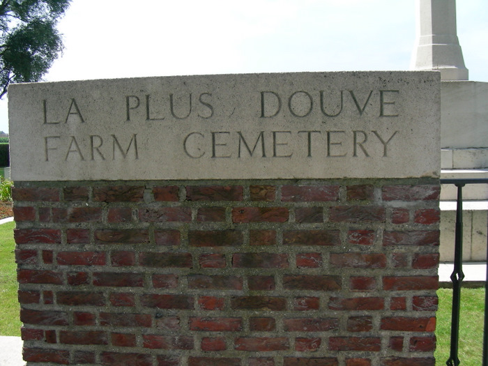
Historical Information: In the valley of the river Douve, north of Ploegsteert Wood, were two farms. La Petite Douve was the object of a successful raid by the 7th Canadian Infantry Battalion in November 1915 and La Plus Douve, which was generally within the Allied lines, was used at times as a battalion headquarters. It was also known as Ration Farm because battalion transport could approach it at night with rations. La Plus Douve Farm Cemetery was begun in April 1915 by the 48th (South Midland) Division and continued in use until May 1918, when it fell into German hands. The cemetery contains 336 Commonwealth burials of the First World War. The cemetery was designed by Charles Holden.
No. of Identified Casualties: 345
Location Information: La Plus Douve Farm Cemetery is located 10.5 kilometres south of Ieper town centre on a road leading from the Rijselseweg (N365) which connects Ieper to Wijtschate, and on to Armentieres. From Ieper town centre the Rijselsestraat runs from the market square, through the Lille Gate (Rijselpoort) and directly over the crossroads with the Ieper ring road. The road name then changes to the Rijselseweg. On reaching the town of Mesen the first right hand turning leads onto the Nieuwkerkestraat (N314). 2 kilometres along the Nieuwkerkestraat lies the left hand turning onto Plus Douve. The cemetery lies 600 metres along Plus Douve on the right hand side of the track. Visitors should note there is an 80 metre grassed access path which is unsuitable for vehicles.
Historical Information: In the valley of the river Douve, north of Ploegsteert Wood, were two farms. La Petite Douve was the object of a successful raid by the 7th Canadian Infantry Battalion in November 1915 and La Plus Douve, which was generally within the Allied lines, was used at times as a battalion headquarters. It was also known as Ration Farm because battalion transport could approach it at night with rations. La Plus Douve Farm Cemetery was begun in April 1915 by the 48th (South Midland) Division and continued in use until May 1918, when it fell into German hands. The cemetery contains 336 Commonwealth burials of the First World War. The cemetery was designed by Charles Holden.
No. of Identified Casualties: 345
Nearby cemeteries

Comines-Warneton, Arrondissement de Mouscron, Hainaut, Belgium
- Total memorials196
- Percent photographed97%
- Percent with GPS1%

Comines-Warneton, Arrondissement de Mouscron, Hainaut, Belgium
- Total memorials455
- Percent photographed100%
- Percent with GPS0%

Wulvergem, Arrondissement Ieper, West Flanders, Belgium
- Total memorials58
- Percent photographed97%
- Percent with GPS0%

Nieuwkerke, Arrondissement Ieper, West Flanders, Belgium
- Total memorials439
- Percent photographed100%
- Percent with GPS3%
- Added: 9 Aug 2005
- Find a Grave Cemetery ID: 2150657

Cemetery Photos
This is a carousel with slides. Use Next and Previous buttons to navigate, or jump to a slide with the slide dots. Use Escape keyboard button or the Close button to close the carousel.

Success
Uploading...
Waiting...
Failed
This photo was not uploaded because this cemetery already has 20 photos
This photo was not uploaded because you have already uploaded 5 photos to this cemetery
This photo was not uploaded because you have already uploaded 5 photos to this cemetery
Invalid File Type
Birth and death years unknown.
1 photo picked...
2 photos picked...
Uploading 1 Photo
Uploading 2 Photos
1 Photo Uploaded
2 Photos Uploaded
Size exceeded
Too many photos have been uploaded
"Unsupported file type"
• ##count## of 0 memorials with GPS displayed. Double click on map to view more.No cemeteries found