Keefers Cemetery
Upper Strasburg, Franklin County, Pennsylvania, USA
About
-
Get directions Upper Horse Valley Road
Upper Strasburg, Pennsylvania 17265 United StatesCoordinates: 40.04066, -77.80791 - Cemetery ID:
Members have Contributed
Advertisement
Photos


10. Norland Ave turns right and becomes US-11 N/Philadelphia Ave 2.3 mi
11. Turn left onto PA-433 N/Sunset Pike
Continue to follow PA-433 N 1.7 mi
12. Continue onto PA-997 N/Cumberland Hwy 4.0 mi
13. Turn left onto PA-533 W/Upper Strasburg Rd
Continue to follow Upper Strasburg Rd 6.2 mi
14. Turn left onto State Route 4004/Upper Strasburg Rd 1.6 mi
15. Slight left onto Upper Horse Valley Rd 6.2 mi
16. Continue onto Horse Valley Rd 371 ft
*See below for remainder of directions.
A big thank you to Larry Hoover for the following directions.
From Upper Strasburg, PA to the cemetery:
Start at Upper Strasburg, PA. Drive up the mountain on Upper Strasburg Rd. (State Route 4004). Follow the road to the right at top of mountain. Stay on this road until a Y or road to left. Take the road to the left (Upper Horse Valley Road).
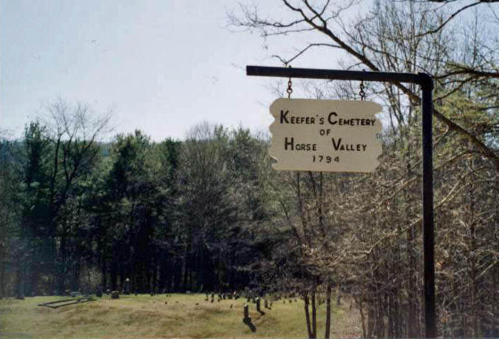
*Continue on Upper Horse Valley Rd. until you come to a small white church on the right with a parking area on the left. At the parking area you should see the sign and entrance Rd. to the Cemetery. You have to walk back this road to the Cemetery.
Find a Grave's GPS coordinates differ from Google Earth's. When I enter Google Earth's coordinates for the cemetery into findagrave, the map below shows a location outside of Shippensburg. Therefore, I don't know if findagrave's coordinates are accurate. Here are Google Earth's coordinates for this cemetery: 40:02:26.86N; 77:48:28.03W
10. Norland Ave turns right and becomes US-11 N/Philadelphia Ave 2.3 mi
11. Turn left onto PA-433 N/Sunset Pike
Continue to follow PA-433 N 1.7 mi
12. Continue onto PA-997 N/Cumberland Hwy 4.0 mi
13. Turn left onto PA-533 W/Upper Strasburg Rd
Continue to follow Upper Strasburg Rd 6.2 mi
14. Turn left onto State Route 4004/Upper Strasburg Rd 1.6 mi
15. Slight left onto Upper Horse Valley Rd 6.2 mi
16. Continue onto Horse Valley Rd 371 ft
*See below for remainder of directions.
A big thank you to Larry Hoover for the following directions.
From Upper Strasburg, PA to the cemetery:
Start at Upper Strasburg, PA. Drive up the mountain on Upper Strasburg Rd. (State Route 4004). Follow the road to the right at top of mountain. Stay on this road until a Y or road to left. Take the road to the left (Upper Horse Valley Road).
*Continue on Upper Horse Valley Rd. until you come to a small white church on the right with a parking area on the left. At the parking area you should see the sign and entrance Rd. to the Cemetery. You have to walk back this road to the Cemetery.
Find a Grave's GPS coordinates differ from Google Earth's. When I enter Google Earth's coordinates for the cemetery into findagrave, the map below shows a location outside of Shippensburg. Therefore, I don't know if findagrave's coordinates are accurate. Here are Google Earth's coordinates for this cemetery: 40:02:26.86N; 77:48:28.03W
Nearby cemeteries

Franklin County, Pennsylvania, USA
- Total memorials10
- Percent photographed60%
- Percent with GPS20%

Freestone, Franklin County, Pennsylvania, USA
- Total memorials6
- Percent photographed83%
- Percent with GPS83%

Fannettsburg, Franklin County, Pennsylvania, USA
- Total memorials790
- Percent photographed71%
- Percent with GPS5%

Fannettsburg, Franklin County, Pennsylvania, USA
- Total memorials438
- Percent photographed89%
- Percent with GPS0%
- Added: 15 Jun 2007
- Find a Grave Cemetery ID: 2220568

Cemetery Photos
This is a carousel with slides. Use Next and Previous buttons to navigate, or jump to a slide with the slide dots. Use Escape keyboard button or the Close button to close the carousel.


Success
Uploading...
Waiting...
Failed
This photo was not uploaded because this cemetery already has 20 photos
This photo was not uploaded because you have already uploaded 5 photos to this cemetery
This photo was not uploaded because you have already uploaded 5 photos to this cemetery
Invalid File Type
Birth and death years unknown.
1 photo picked...
2 photos picked...
Uploading 1 Photo
Uploading 2 Photos
1 Photo Uploaded
2 Photos Uploaded
Size exceeded
Too many photos have been uploaded
"Unsupported file type"
• ##count## of 0 memorials with GPS displayed. Double click on map to view more.No cemeteries found