Springfield Friends Cemetery
Adams Township, Clinton County, Ohio, USA
About
-
Get directions 121 Todds Fork road
Adams Township, Ohio 45177 United StatesCoordinates: 39.45130, -83.93758 - Cemetery ID:
Members have Contributed
Advertisement
Photos


1813 ﻬ First burial Lydia Harvey.
1820 ﻬ Members to keep grave yard in decent order.
1821 ﻬ Joshua Harvey employed as grave digger at rate of 50c per grave.
1828 ﻬ New rail fence around cemetery was built.
1830 ﻬ Fence repairs.
1837 ﻬ Grave yard enlarged to north line of lot. Mound leveled.
1887 ﻬ Springfield Cemetery Association was formed, and was Chartered by the State.
.
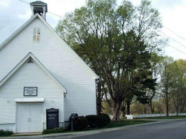
The cemetery is located on the north side of Todds Fork Road (Township Road 260) about 0.1 miles east of its intersection with Ohio State Route 380.
The cemetery is located in Adams Township, Clinton County, Ohio, and is # 1949 (Springfield Friends Cemetery) in "Ohio Cemeteries 1803-2003", compiled by the Ohio Genealogical Society.
1813 ﻬ First burial Lydia Harvey.
1820 ﻬ Members to keep grave yard in decent order.
1821 ﻬ Joshua Harvey employed as grave digger at rate of 50c per grave.
1828 ﻬ New rail fence around cemetery was built.
1830 ﻬ Fence repairs.
1837 ﻬ Grave yard enlarged to north line of lot. Mound leveled.
1887 ﻬ Springfield Cemetery Association was formed, and was Chartered by the State.
.
The cemetery is located on the north side of Todds Fork Road (Township Road 260) about 0.1 miles east of its intersection with Ohio State Route 380.
The cemetery is located in Adams Township, Clinton County, Ohio, and is # 1949 (Springfield Friends Cemetery) in "Ohio Cemeteries 1803-2003", compiled by the Ohio Genealogical Society.
Nearby cemeteries
Adams Township, Clinton County, Ohio, USA
- Total memorials1
- Percent photographed0%
- Percent with GPS0%
Clarksville, Clinton County, Ohio, USA
- Total memorials11
- Percent photographed18%
- Percent with GPS0%

Clarksville, Clinton County, Ohio, USA
- Total memorials7
- Percent photographed100%
- Percent with GPS0%

Wilmington, Clinton County, Ohio, USA
- Total memorials30
- Percent photographed83%
- Percent with GPS33%
- Added: 3 Oct 2006
- Find a Grave Cemetery ID: 2191443

Cemetery Photos
This is a carousel with slides. Use Next and Previous buttons to navigate, or jump to a slide with the slide dots. Use Escape keyboard button or the Close button to close the carousel.


Success
Uploading...
Waiting...
Failed
This photo was not uploaded because this cemetery already has 20 photos
This photo was not uploaded because you have already uploaded 5 photos to this cemetery
This photo was not uploaded because you have already uploaded 5 photos to this cemetery
Invalid File Type
Birth and death years unknown.
1 photo picked...
2 photos picked...
Uploading 1 Photo
Uploading 2 Photos
1 Photo Uploaded
2 Photos Uploaded
Size exceeded
Too many photos have been uploaded
"Unsupported file type"
• ##count## of 0 memorials with GPS displayed. Double click on map to view more.No cemeteries found