Avondale Cemetery
Stratford, Perth County, Ontario, Canada
About
-
- www.stratford.ca/en/live-here/cemetery.aspx
- 519-271-0250
- Cemetery ID:
Members have Contributed
Advertisement
Photos


The original portion (Blocks A - W and Pottersfield) was opened in 1871 and is located on the north bank of the Avon River, southwest of the city centre. In 1883, the Roman Catholic church opened a portion (12 sections with Saints names), adjacent on the west, for their cemetery expansion, but this is now also city-owned. Further expansion since the early 1900s has made available additional sections west of the older parts (Ranges 1 - 26 and New Soldiers). A map is available for download at the official cemetery page .
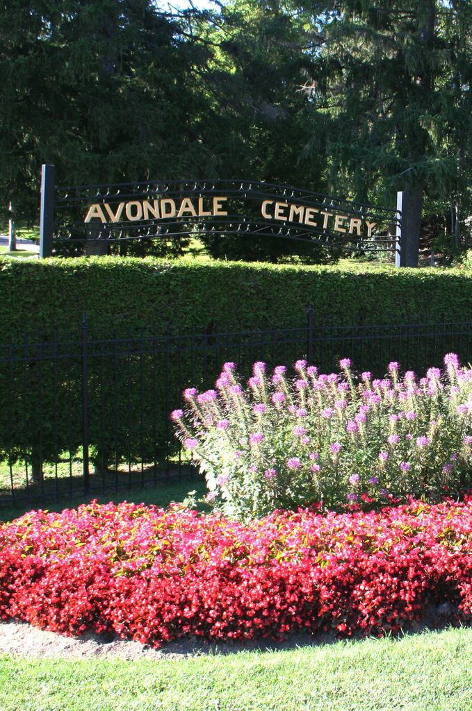
Avondale has a park-like setting, with many trees, flower-beds, well-maintained grounds, and paved but narrow roadways. Some sections are on steep inclines. There are several access points to the T.J. Dolan Natural Area across the river.
Breakdown
Blocks A - W, 20 ac (8 ha) - almost 13,000 interments (est. 95% capacity)
Catholic sections with Saints names, 15 ac (6 ha) - almost 5,000 interments (est. 80% capacity)
Ranges 1 - 26, 33 ac (13.5 ha) - almost 13,000 interments (est. 75% capacity)
There also several mausoleums, family crypts and columbariums in the cemetery (about 1400 interments, 50% capacity of current structures). A Scattering Garden with a memorial plaque was initiated in May 2020 and a new Columbarium built in Aug 2020.
Another 40 acres (16 hectares), reaching to O'Loane Ave. on the west, are currently (2020) still undeveloped and in use as farmland.
Main gates are on Avondale Avenue and on John Street. The cemetery office is just outside the Avondale Avenue entrance. (Other access points are footpaths or for cemetery and emergency use only).
The grave monuments are diverse: slabs, obelisks, crosses, flat markers, rocks, niches, benches, and others. Not all graves are marked.
Avondale uses the vault area in the Chapel as winter storage. Some of those in the "Unknown" Section and in "001 - Winter Storage" Section were only temporarily at Avondale, and were then buried in other area cemeteries.
There are many re-interments at Avondale, especially from other local cemeteries that were closed: Saint Andrews Presbyterian Cemetery, Stratford (all known graves moved, most in the 1870s); Saint James Anglican Churchyard, Stratford; Dunn's Bridge Knox Presbyterian and Dunn's Bridge Methodist Cemeteries, Downie Township; and St. Josephs Roman Catholic Cemetery, Ellice Township. The 2 graves at the Stratford Jail were removed to Avondale in 2011. Stones and graves remain at all these except Saint Andrews and the Jail, and only Saint James Churchyard is still active, as the God's Holy Acre memorial garden.
Tips for finding a grave at Avondale
1. Use the surname search at https://www.stratford.ca/en/live-here/cemetery.aspx (Do not use wildcards). Results include given and last names as used in the cemetery records, interment date and grave location.
2. Use the cemetery map to locate the referenced section. Grave numbers generally run sequentially along east-west rows, starting from the northeast, but some sections have rows that run north-south or have numbering that zigzags along the rows.
Notes: Some of the small areas named in the cemetery database are not named on the map. The Avondale Cemetery Office (contact information on search page) can help with grave location, but does not seem to have accessible records as to how or if a grave was marked.
3. If not sure of the exact surname spelling or the cemetery, use the OCFA database at ocfa.islandnet.com/ocfa-search.php
(This database was compiled from transcription books which date from the mid-1990s, and includes referenced names as well as the principals interred or with pre-need stones in a cemetery, but no dates. There are 25,000 names in this database for Avondale Cemetery).
The Avondale Cemetery transcriptions (last updated in the 1990s) are available at the Stratford Archives (https://www.perthcounty.ca/en/StratfordPerthArchives.aspx) or through the Perth Branch of the Ontario Genealogical Society (https://perthcountyogs.org/).
The original portion (Blocks A - W and Pottersfield) was opened in 1871 and is located on the north bank of the Avon River, southwest of the city centre. In 1883, the Roman Catholic church opened a portion (12 sections with Saints names), adjacent on the west, for their cemetery expansion, but this is now also city-owned. Further expansion since the early 1900s has made available additional sections west of the older parts (Ranges 1 - 26 and New Soldiers). A map is available for download at the official cemetery page .
Avondale has a park-like setting, with many trees, flower-beds, well-maintained grounds, and paved but narrow roadways. Some sections are on steep inclines. There are several access points to the T.J. Dolan Natural Area across the river.
Breakdown
Blocks A - W, 20 ac (8 ha) - almost 13,000 interments (est. 95% capacity)
Catholic sections with Saints names, 15 ac (6 ha) - almost 5,000 interments (est. 80% capacity)
Ranges 1 - 26, 33 ac (13.5 ha) - almost 13,000 interments (est. 75% capacity)
There also several mausoleums, family crypts and columbariums in the cemetery (about 1400 interments, 50% capacity of current structures). A Scattering Garden with a memorial plaque was initiated in May 2020 and a new Columbarium built in Aug 2020.
Another 40 acres (16 hectares), reaching to O'Loane Ave. on the west, are currently (2020) still undeveloped and in use as farmland.
Main gates are on Avondale Avenue and on John Street. The cemetery office is just outside the Avondale Avenue entrance. (Other access points are footpaths or for cemetery and emergency use only).
The grave monuments are diverse: slabs, obelisks, crosses, flat markers, rocks, niches, benches, and others. Not all graves are marked.
Avondale uses the vault area in the Chapel as winter storage. Some of those in the "Unknown" Section and in "001 - Winter Storage" Section were only temporarily at Avondale, and were then buried in other area cemeteries.
There are many re-interments at Avondale, especially from other local cemeteries that were closed: Saint Andrews Presbyterian Cemetery, Stratford (all known graves moved, most in the 1870s); Saint James Anglican Churchyard, Stratford; Dunn's Bridge Knox Presbyterian and Dunn's Bridge Methodist Cemeteries, Downie Township; and St. Josephs Roman Catholic Cemetery, Ellice Township. The 2 graves at the Stratford Jail were removed to Avondale in 2011. Stones and graves remain at all these except Saint Andrews and the Jail, and only Saint James Churchyard is still active, as the God's Holy Acre memorial garden.
Tips for finding a grave at Avondale
1. Use the surname search at https://www.stratford.ca/en/live-here/cemetery.aspx (Do not use wildcards). Results include given and last names as used in the cemetery records, interment date and grave location.
2. Use the cemetery map to locate the referenced section. Grave numbers generally run sequentially along east-west rows, starting from the northeast, but some sections have rows that run north-south or have numbering that zigzags along the rows.
Notes: Some of the small areas named in the cemetery database are not named on the map. The Avondale Cemetery Office (contact information on search page) can help with grave location, but does not seem to have accessible records as to how or if a grave was marked.
3. If not sure of the exact surname spelling or the cemetery, use the OCFA database at ocfa.islandnet.com/ocfa-search.php
(This database was compiled from transcription books which date from the mid-1990s, and includes referenced names as well as the principals interred or with pre-need stones in a cemetery, but no dates. There are 25,000 names in this database for Avondale Cemetery).
The Avondale Cemetery transcriptions (last updated in the 1990s) are available at the Stratford Archives (https://www.perthcounty.ca/en/StratfordPerthArchives.aspx) or through the Perth Branch of the Ontario Genealogical Society (https://perthcountyogs.org/).
Nearby cemeteries

Stratford, Perth County, Ontario, Canada
- Total memorials266
- Percent photographed95%
- Percent with GPS9%

Downie Township, Perth County, Ontario, Canada
- Total memorials42
- Percent photographed95%
- Percent with GPS86%

Stratford, Perth County, Ontario, Canada
- Total memorials17
- Percent photographed100%
- Percent with GPS100%

Stratford, Perth County, Ontario, Canada
- Total memorials179
- Percent photographed58%
- Percent with GPS0%
- Added: 22 Jul 2001
- Find a Grave Cemetery ID: 639403

Cemetery Photos
This is a carousel with slides. Use Next and Previous buttons to navigate, or jump to a slide with the slide dots. Use Escape keyboard button or the Close button to close the carousel.


Success
Uploading...
Waiting...
Failed
This photo was not uploaded because this cemetery already has 20 photos
This photo was not uploaded because you have already uploaded 5 photos to this cemetery
This photo was not uploaded because you have already uploaded 5 photos to this cemetery
Invalid File Type
Birth and death years unknown.
1 photo picked...
2 photos picked...
Uploading 1 Photo
Uploading 2 Photos
1 Photo Uploaded
2 Photos Uploaded
Size exceeded
Too many photos have been uploaded
"Unsupported file type"
• ##count## of 0 memorials with GPS displayed. Double click on map to view more.No cemeteries found