Mead-Burney-Gibbs Cemetery
Purdy, Madison County, Arkansas, USA
Directions: From Huntsville take Highway 23 South for 4 miles; turn left on Highway 74 and go for 2 1/4 miles. Turn left on County Road #2185 and go 1 1/4 miles; Turn left on County Road #2187 for 1 1/4 miles; then turn left on County Road #2410 and go 1 1/4 miles. Turn right on County Road #2400 and go about 2 1/2 to 3 miles. You will be at a farm with address of 2622 Madison 2400. You will need permission of the landowner to continue.
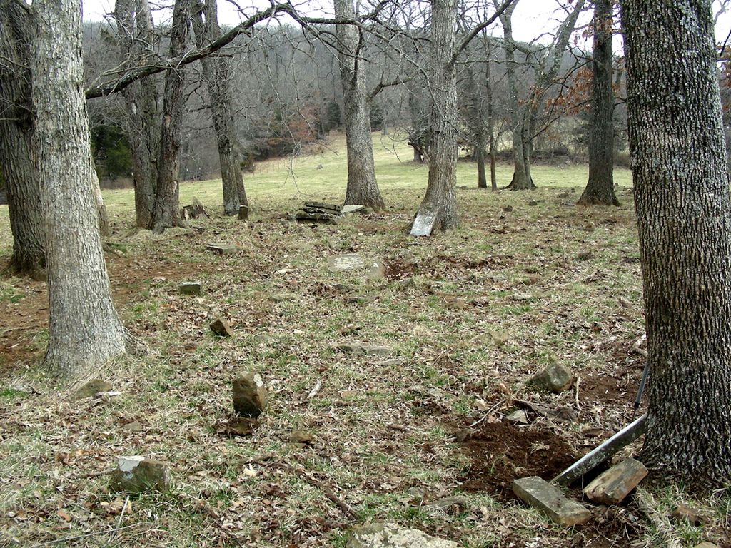
To reach the cemetery you must travel through a pasture; ford Reeds Creek; travel on through a cattle corral; cross another small stream; and go up a steep hill in a pasture. The cemetery is located in a grove of trees and has no fence around it, in the SW 1/4 of the SE 1/4, Section 5, Township 16 North, Range 25 West. On April 3, 2006, I visited the cemetery, stood among the broken tombstones & took the GPS coordinates of N36.07020 W -093.64201.
Henry Wall owned this property for over 50 years and he said when he first moved here that he counted 28 fieldstone graves at this location. Because there is no fence and cattle have stood in it, the stones have been knocked down and covered up by dirt.
Joy Russell, Madison County Genealogical & Historical Society
Directions: From Huntsville take Highway 23 South for 4 miles; turn left on Highway 74 and go for 2 1/4 miles. Turn left on County Road #2185 and go 1 1/4 miles; Turn left on County Road #2187 for 1 1/4 miles; then turn left on County Road #2410 and go 1 1/4 miles. Turn right on County Road #2400 and go about 2 1/2 to 3 miles. You will be at a farm with address of 2622 Madison 2400. You will need permission of the landowner to continue.
To reach the cemetery you must travel through a pasture; ford Reeds Creek; travel on through a cattle corral; cross another small stream; and go up a steep hill in a pasture. The cemetery is located in a grove of trees and has no fence around it, in the SW 1/4 of the SE 1/4, Section 5, Township 16 North, Range 25 West. On April 3, 2006, I visited the cemetery, stood among the broken tombstones & took the GPS coordinates of N36.07020 W -093.64201.
Henry Wall owned this property for over 50 years and he said when he first moved here that he counted 28 fieldstone graves at this location. Because there is no fence and cattle have stood in it, the stones have been knocked down and covered up by dirt.
Joy Russell, Madison County Genealogical & Historical Society
Nearby cemeteries

Madison County, Arkansas, USA
- Total memorials40
- Percent photographed93%
- Percent with GPS0%

Huntsville, Madison County, Arkansas, USA
- Total memorials3
- Percent photographed100%
- Percent with GPS0%

Madison County, Arkansas, USA
- Total memorials19
- Percent photographed100%
- Percent with GPS0%

Alabam, Madison County, Arkansas, USA
- Total memorials26
- Percent photographed85%
- Percent with GPS0%
- Added: 28 Feb 2010
- Find a Grave Cemetery ID: 2343714

Cemetery Photos
This is a carousel with slides. Use Next and Previous buttons to navigate, or jump to a slide with the slide dots. Use Escape keyboard button or the Close button to close the carousel.
Success
Uploading...
Waiting...
Failed
This photo was not uploaded because this cemetery already has 20 photos
This photo was not uploaded because you have already uploaded 5 photos to this cemetery
This photo was not uploaded because you have already uploaded 5 photos to this cemetery
Invalid File Type
Birth and death years unknown.
1 photo picked...
2 photos picked...
Uploading 1 Photo
Uploading 2 Photos
1 Photo Uploaded
2 Photos Uploaded
Size exceeded
Too many photos have been uploaded
"Unsupported file type"
• ##count## of 0 memorials with GPS displayed. Double click on map to view more.No cemeteries found