St. Michael's Churchyard
Sutton Bonington, Rushcliffe Borough, Nottinghamshire, England
About
-
Get directions 102 Main Street, Sutton Bonington, Loughborough
Sutton Bonington, Rushcliffe Borough, Nottinghamshire LE12 5PF EnglandCoordinates: 52.82407, -1.25299 - southwellchurches.nottingham.ac.uk/sutton-bonington-st-michael/hchyard.php
- Cemetery ID:
Members have Contributed
Advertisement
Photos

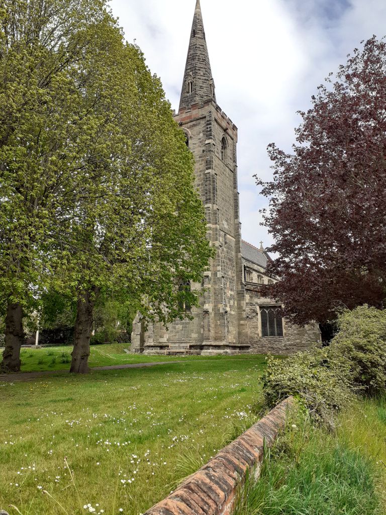
"Sutton Bonington has two parish churches, St Michael's and St Anne's, dating back to the time when Sutton and Bonington were two separate villages, Bonitone (St Michael's) and Sudtone (St Anne's) according to the Domesday Survey of 1086. The survey does not mention a church in either village. The two parishes gradually grew together but remained officially separate until 1829 when local government reforms were introduced. Ecclesiastically they remained separate until the two parishes agreed to unite in 1923 by order of the Privy Council. However, this could not take place until both parishes were in interregnum: this eventually happened in 1950. Both churches continue to be used."
"Sutton Bonington has two parish churches, St Michael's and St Anne's, dating back to the time when Sutton and Bonington were two separate villages, Bonitone (St Michael's) and Sudtone (St Anne's) according to the Domesday Survey of 1086. The survey does not mention a church in either village. The two parishes gradually grew together but remained officially separate until 1829 when local government reforms were introduced. Ecclesiastically they remained separate until the two parishes agreed to unite in 1923 by order of the Privy Council. However, this could not take place until both parishes were in interregnum: this eventually happened in 1950. Both churches continue to be used."
Nearby cemeteries

Sutton Bonington, Rushcliffe Borough, Nottinghamshire, England
- Total memorials147
- Percent photographed100%
- Percent with GPS0%

Sutton Bonington, Rushcliffe Borough, Nottinghamshire, England
- Total memorials127
- Percent photographed98%
- Percent with GPS57%

Normanton-on-Soar, Rushcliffe Borough, Nottinghamshire, England
- Total memorials162
- Percent photographed89%

Kegworth, North West Leicestershire District, Leicestershire, England
- Total memorials322
- Percent photographed74%
- Percent with GPS65%
- Added: 21 Apr 2020
- Find a Grave Cemetery ID: 2704791

Cemetery Photos
This is a carousel with slides. Use Next and Previous buttons to navigate, or jump to a slide with the slide dots. Use Escape keyboard button or the Close button to close the carousel.

Success
Uploading...
Waiting...
Failed
This photo was not uploaded because this cemetery already has 20 photos
This photo was not uploaded because you have already uploaded 5 photos to this cemetery
This photo was not uploaded because you have already uploaded 5 photos to this cemetery
Invalid File Type
Birth and death years unknown.
1 photo picked...
2 photos picked...
Uploading 1 Photo
Uploading 2 Photos
1 Photo Uploaded
2 Photos Uploaded
Size exceeded
Too many photos have been uploaded
"Unsupported file type"
• ##count## of 0 memorials with GPS displayed. Double click on map to view more.No cemeteries found