Te Rua o Pueru
Aramiro, Waikato District, Waikato, New Zealand
About
-
Get directions Waitetuna Valley Road
Aramiro, Waikato District, Waikato 3293 New ZealandCoordinates: -37.88562, 175.02766 - Cemetery ID:
Members have Contributed
Advertisement
Photos
No additional photos.
Add PhotosIt is difficult to articulate the number of interments here, for the longest time - because of the absence of headstones, which were regarded as non-traditional.
The first headstone was permitted by sanction of the late Maori Queen, Dame Te Arikinui Te Atairangikaahu in 1973.
The original name for this location was TE PIRAU, named in consequence of the spoiling of stored food in ground pits. TE RUA O PUERU in practice refers to the land immediately opposite.
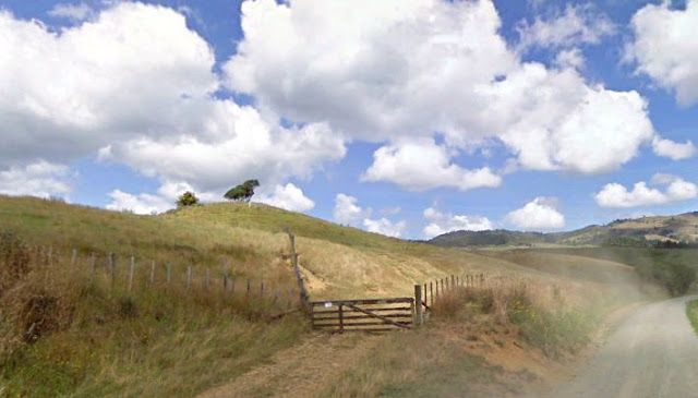
PUERU URUPA is situate on a hill overlooking the Aramiro Valley. It is located on the corner of Waitetuna Valley Road and Vandy Road. Access to the actual fenced burial ground requires crossing over farm land, which is not permitted by anyone other than members of the tribe.
The Chief, TE HERUIKA II is the oldest interment at Pueru, known to the Author.
It is difficult to articulate the number of interments here, for the longest time - because of the absence of headstones, which were regarded as non-traditional.
The first headstone was permitted by sanction of the late Maori Queen, Dame Te Arikinui Te Atairangikaahu in 1973.
The original name for this location was TE PIRAU, named in consequence of the spoiling of stored food in ground pits. TE RUA O PUERU in practice refers to the land immediately opposite.
PUERU URUPA is situate on a hill overlooking the Aramiro Valley. It is located on the corner of Waitetuna Valley Road and Vandy Road. Access to the actual fenced burial ground requires crossing over farm land, which is not permitted by anyone other than members of the tribe.
The Chief, TE HERUIKA II is the oldest interment at Pueru, known to the Author.
Nearby cemeteries

Te Uku, Waikato District, Waikato, New Zealand
- Total memorials133
- Percent photographed95%
- Percent with GPS32%

Te Uku, Waikato District, Waikato, New Zealand
- Total memorials69
- Percent photographed100%
- Percent with GPS86%

Te Uku, Waikato District, Waikato, New Zealand
- Total memorials61
- Percent photographed100%
- Percent with GPS0%

Okete, Waikato District, Waikato, New Zealand
- Total memorials167
- Percent photographed87%
- Percent with GPS4%
- Added: 12 Jul 2018
- Find a Grave Cemetery ID: 2669061

Cemetery Photos
This is a carousel with slides. Use Next and Previous buttons to navigate, or jump to a slide with the slide dots. Use Escape keyboard button or the Close button to close the carousel.
Success
Uploading...
Waiting...
Failed
This photo was not uploaded because this cemetery already has 20 photos
This photo was not uploaded because you have already uploaded 5 photos to this cemetery
This photo was not uploaded because you have already uploaded 5 photos to this cemetery
Invalid File Type
Birth and death years unknown.
1 photo picked...
2 photos picked...
Uploading 1 Photo
Uploading 2 Photos
1 Photo Uploaded
2 Photos Uploaded
Size exceeded
Too many photos have been uploaded
"Unsupported file type"
• ##count## of 0 memorials with GPS displayed. Double click on map to view more.No cemeteries found