Orr Chapel Cemetery
Sandy Hook, Maury County, Tennessee, USA
About
-
- Cemetery ID:
Members have Contributed
Advertisement
Photos


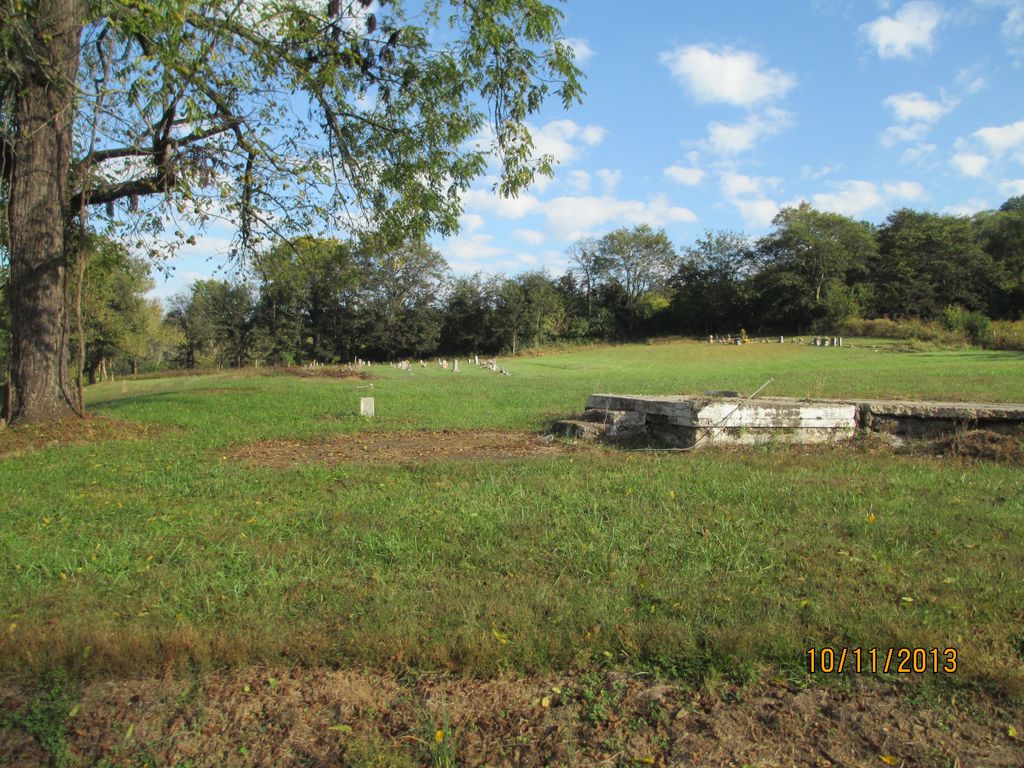
This African-American cemetery is located in Sheepneck Hollow on Sheepneck Road, next to Sheepneck Cemetery.
Directions from Google maps (with info from my trip):
From Highway 43/412 intersection, go south on Hwy 43 for 12 miles and take New Lawrenceburg Hwy on the left. There is a sign on the right pointing the way to Sandy Hook; the word "New" is not visible, but "Lawrenceburg Hwy" can be seen from Hwy 43. Drive for about 0.6 miles to W Sheepneck Road on the right; it comes up rather unexpectedly, so drive slow - going strait will put you on Johnson Hill Road. In less than half a mile, after a large "S" in the road, there is a clearing on the left where the cemetery is. On the far side is a driveway between a house and the foundation of what must have been the Orr Chapel.
Sheepneck Cemetery is located in the trees that were right before the clearing - ie, in the left background of the last picture on this page.
Nearby cemeteries

Sandy Hook, Maury County, Tennessee, USA
- Total memorials59
- Percent photographed22%
- Percent with GPS2%

Sandy Hook, Maury County, Tennessee, USA
- Total memorials27
- Percent photographed67%
- Percent with GPS4%

Mount Pleasant, Maury County, Tennessee, USA
- Total memorials8
- Percent photographed100%
- Percent with GPS0%
Maury County, Tennessee, USA
- Total memorials11
- Percent photographed0%
- Percent with GPS0%
- Added: 11 Oct 2013
- Find a Grave Cemetery ID: 2515877

Cemetery Photos
This is a carousel with slides. Use Next and Previous buttons to navigate, or jump to a slide with the slide dots. Use Escape keyboard button or the Close button to close the carousel.


Success
Uploading...
Waiting...
Failed
This photo was not uploaded because this cemetery already has 20 photos
This photo was not uploaded because you have already uploaded 5 photos to this cemetery
This photo was not uploaded because you have already uploaded 5 photos to this cemetery
Invalid File Type
Birth and death years unknown.
1 photo picked...
2 photos picked...
Uploading 1 Photo
Uploading 2 Photos
1 Photo Uploaded
2 Photos Uploaded
Size exceeded
Too many photos have been uploaded
"Unsupported file type"
• ##count## of 0 memorials with GPS displayed. Double click on map to view more.No cemeteries found