Newdale Municipal Cemetery
Also known as Harrison Municipal Cemetery
Newdale, Western Manitoba Census Division, Manitoba, Canada
About
-
Get directions 92010Provincial Road 119W
Newdale, RM of Harrison Park, Manitoba
R0J 1J0 CanadaCoordinates: 50.36100, -100.20744 - harrisonpark.ca/p/cemeteries
- [email protected]
- +1-204-848-7614
-
Office Address
P.O. Box 190
43 Gateway St
Onanole, RM of Harrison Park, Manitoba
ROJ 1NO Canada - Cemetery ID:
-
Additional information
Located in proximity to and just north of the town of Newdale, MB, on Provincial Road 119W, which extends from northward from the junction of Provincial Road 250 and Provincial Highway 16 (aka The Yellowhead Highway)
Queries about burials in this cemetery can be addressed to the staff of the RM of Harrison
Members have Contributed
Advertisement
Photos

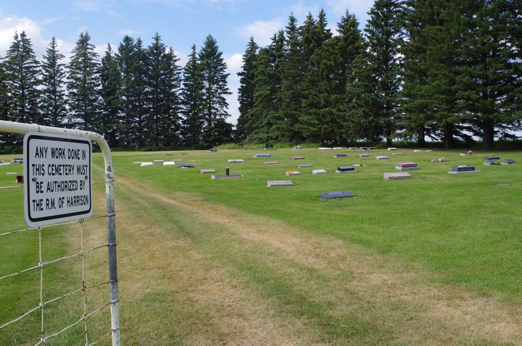
Established in 1951, this cemetery is owned and managed by the RM of Harrison Park.
It is a neat well-kept cemetery with all flat stones facing east.
(Source: Manitoba Genealogical Society [Adapted])
It is not to be confused with the former Oldale (aka Newdale) Cemetery south of the town site.
(Source: Manitoba Historical Society [Adapted])
In the spring of 1950, the council bought five acres (2.0 hectares) of land from Stanley Petrynychyn and fenced three acres to form a cemetery. The other two acres were to be used at a later date if needed.
The original board were: J.H. Coutts, C. Lamb and T. Rose for three years. Mrs. R. Westaway, J. Wyton and Ed Dalke for two years, and J.L. Young, Mrs. D. Dalgarno, and R. Mason for a time.
The secretaries have been: R. Mason, J. Wyton and B. Hawes. At the present time, the secretary is George Wareham and the president is N. Kingdon. (1970)
(Source: Newdale, 1870-1970, p 32 [Adapted])
Dominion Land Survey coordinates: LSD01-18-16-20-W1
As noted above, a part of the town's story and those of its inhabitants from the early days of European settlement through roughly 1970 is told in the volume "Newdale, 1870-1970". A free digital version of this and many other Manitoba local history books can be found online in the University of Manitoba Digital Collections. There is also a list of such books organized by district and town name on the Manitoba Historical Society's website on their page entitled "Finding Aid: Manitoba Local History Books".
A list of burials in this cemetery is available from the Manitoba Genealogical Society (reference #0860), transcribed by a member or members in 1994. Also available to MGS members is a searchable online database named the "MGS Manitoba Name Index" (or MANI). Some additional information is contained in the 1996 MGS publication "Carved in Stone: Manitoba Cemeteries and Burial Sites" (revised edition, Special Projects Publication, 106 pages).
Nearby cemeteries

Newdale, Western Manitoba Census Division, Manitoba, Canada
- Total memorials39
- Percent photographed97%
- Percent with GPS0%

Newdale, Western Manitoba Census Division, Manitoba, Canada
- Total memorials597
- Percent photographed53%
- Percent with GPS0%

Cardale, Western Manitoba Census Division, Manitoba, Canada
- Total memorials3
- Percent photographed0%
- Percent with GPS0%

Strathclair, Western Manitoba Census Division, Manitoba, Canada
- Total memorials323
- Percent photographed97%
- Percent with GPS7%
- Added: 5 Jan 2012
- Find a Grave Cemetery ID: 2432297

Cemetery Photos
This is a carousel with slides. Use Next and Previous buttons to navigate, or jump to a slide with the slide dots. Use Escape keyboard button or the Close button to close the carousel.

Success
Uploading...
Waiting...
Failed
This photo was not uploaded because this cemetery already has 20 photos
This photo was not uploaded because you have already uploaded 5 photos to this cemetery
This photo was not uploaded because you have already uploaded 5 photos to this cemetery
Invalid File Type
Birth and death years unknown.
1 photo picked...
2 photos picked...
Uploading 1 Photo
Uploading 2 Photos
1 Photo Uploaded
2 Photos Uploaded
Size exceeded
Too many photos have been uploaded
"Unsupported file type"
• ##count## of 0 memorials with GPS displayed. Double click on map to view more.No cemeteries found