Hardin Cemetery #2
Also known as Elmo Clore Cemetery
Oldham County, Kentucky, USA
About
-
Get directions Near Prospect & River Bluff, 1 mile off old KY Hwy 329
null, Kentucky 40059 United StatesCoordinates: 38.36108, -85.57504 - Cemetery ID:
Members have Contributed
Advertisement


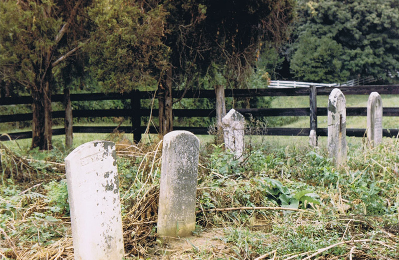
Cemetery #13 is the cemetery number which the Oldham County Historical Society put on it when they published the book "Oldham County Records, Vol. I, Cemeteries, by McKechnie and Dent". They list the name as "Hardin Cemetery 2" in the book although they admit not knowing the location of the cemetery nor who may be buried there.
This cemetery used to be known as the Elmo Clore cemetery and was located on the Elmo Clore farm. That was many years ago. In 1986 it was very overgrown with weeds and brush. When I saw it, the cemetery was fenced off with a rectangular wooden fence. My son Chris and I pulled out the overgrown weeds to get to the headstones. In July 2016 when I visited the place the fence had been torn down and the grass mowed. Much more accessible.
Directions to Cemetery: Take I-71 East out of the north top of Louisville to Hwy 329. Turn left onto hwy 329 and go 2.1 miles to 9707 Covered Bridge Rd Driveway. Turn right and go between 2 stone pillars. Drive down the long driveway and you'll come to where you must turn right or left. Turn left and go a few hundred feet and turn right onto the first gravel road you come to. The cemetery is on the right.
Written by Rich Ware
Nearby cemeteries
Pewee Valley, Oldham County, Kentucky, USA
- Total memorials6
- Percent photographed0%
- Percent with GPS0%

River Bluff, Oldham County, Kentucky, USA
- Total memorials10
- Percent photographed70%
- Percent with GPS0%

River Bluff, Oldham County, Kentucky, USA
- Total memorials15
- Percent photographed100%
- Percent with GPS60%

Goshen, Oldham County, Kentucky, USA
- Total memorials22
- Percent photographed73%
- Percent with GPS0%
- Added: 8 Dec 2011
- Find a Grave Cemetery ID: 2429183

Cemetery Photos
This is a carousel with slides. Use Next and Previous buttons to navigate, or jump to a slide with the slide dots. Use Escape keyboard button or the Close button to close the carousel.


Success
Uploading...
Waiting...
Failed
This photo was not uploaded because this cemetery already has 20 photos
This photo was not uploaded because you have already uploaded 5 photos to this cemetery
This photo was not uploaded because you have already uploaded 5 photos to this cemetery
Invalid File Type
Birth and death years unknown.
1 photo picked...
2 photos picked...
Uploading 1 Photo
Uploading 2 Photos
1 Photo Uploaded
2 Photos Uploaded
Size exceeded
Too many photos have been uploaded
"Unsupported file type"
• ##count## of 0 memorials with GPS displayed. Double click on map to view more.No cemeteries found