Alex Bullock Cemetery
Paulding County, Georgia, USA
Although the address for this is listed as "Fennell Road" you can no longer get there as a bridge was washed out and never replaced.
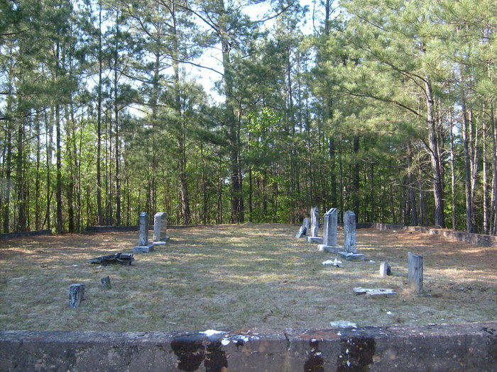
Directions: Traveling west on Highway 278 from Dallas, take a left on Hulseytown Road. Turn left on Red Mountain Road (gravel road) and continue until it dead-ends in a small cul de sac. There will be a dirt road on the right side of the cul de sac. Take that dirt road until you come to the second gate (road dead ends at gate). You will have to park there and walk. Walk around the gate (it is WMA property open to the public) and walk about one mile including crossing some public utility right of way on the uneven dirt road until it dead ends at another gate. Climb a small bank on your left at the gate. Walk across the clearing (site of a hunting camp) and you will find a small trail in the woods on the opposite side of the clearing. The trail goes back in a pine wood. Walk about 200 yards down the trail and it will dead end at the cemetery which is surrounded by the rock wall shown in the photo.
I recommend you do not go during hunting periods as it is in WMA land that is hunted regularly. Be sure to wear very bright clothes, sturdy footwear, jeans and long sleeves. I also recommend avoiding the summer months (snakes) and not going after a rain.
Although the address for this is listed as "Fennell Road" you can no longer get there as a bridge was washed out and never replaced.
Directions: Traveling west on Highway 278 from Dallas, take a left on Hulseytown Road. Turn left on Red Mountain Road (gravel road) and continue until it dead-ends in a small cul de sac. There will be a dirt road on the right side of the cul de sac. Take that dirt road until you come to the second gate (road dead ends at gate). You will have to park there and walk. Walk around the gate (it is WMA property open to the public) and walk about one mile including crossing some public utility right of way on the uneven dirt road until it dead ends at another gate. Climb a small bank on your left at the gate. Walk across the clearing (site of a hunting camp) and you will find a small trail in the woods on the opposite side of the clearing. The trail goes back in a pine wood. Walk about 200 yards down the trail and it will dead end at the cemetery which is surrounded by the rock wall shown in the photo.
I recommend you do not go during hunting periods as it is in WMA land that is hunted regularly. Be sure to wear very bright clothes, sturdy footwear, jeans and long sleeves. I also recommend avoiding the summer months (snakes) and not going after a rain.
Nearby cemeteries

Paulding County, Georgia, USA
- Total memorials1
- Percent photographed100%
- Percent with GPS0%

Dallas, Paulding County, Georgia, USA
- Total memorials9
- Percent photographed67%
- Percent with GPS0%

Paulding County, Georgia, USA
- Total memorials231
- Percent photographed95%
- Percent with GPS5%

Paulding County, Georgia, USA
- Total memorials67
- Percent photographed100%
- Percent with GPS1%
- Added: 23 May 2011
- Find a Grave Cemetery ID: 2403211

Cemetery Photos
This is a carousel with slides. Use Next and Previous buttons to navigate, or jump to a slide with the slide dots. Use Escape keyboard button or the Close button to close the carousel.
Success
Uploading...
Waiting...
Failed
This photo was not uploaded because this cemetery already has 20 photos
This photo was not uploaded because you have already uploaded 5 photos to this cemetery
This photo was not uploaded because you have already uploaded 5 photos to this cemetery
Invalid File Type
Birth and death years unknown.
1 photo picked...
2 photos picked...
Uploading 1 Photo
Uploading 2 Photos
1 Photo Uploaded
2 Photos Uploaded
Size exceeded
Too many photos have been uploaded
"Unsupported file type"
• ##count## of 0 memorials with GPS displayed. Double click on map to view more.No cemeteries found