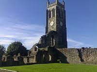
Kilwinning Churchyard
Kilwinning, North Ayrshire, Scotland
About
-
Get directions Main Street, Kilwinning
Kilwinning, North Ayrshire ScotlandCoordinates: 55.65350, -4.69872 - Cemetery ID:
Members have Contributed
Advertisement
Photos
No additional photos.
Add PhotosMain Street, Kilwinning
Lat & Long: 55.6535 & -4.698721 (or 55°39'12.6"N 4°41'55.4"W)
Burials: 16th Century to 1872 (closed in 1872)
Local Authority: North Ayrshire Council
Notes: No records for the Abbey graveyard appear to exist. The Abbey ruins are in the care of Historic Scotland.
Main Street, Kilwinning
Lat & Long: 55.6535 & -4.698721 (or 55°39'12.6"N 4°41'55.4"W)
Burials: 16th Century to 1872 (closed in 1872)
Local Authority: North Ayrshire Council
Notes: No records for the Abbey graveyard appear to exist. The Abbey ruins are in the care of Historic Scotland.
Nearby cemeteries
Kilwinning, North Ayrshire, Scotland
- Total memorials807
- Percent photographed82%
- Percent with GPS18%
Irvine, North Ayrshire, Scotland
- Total memorials3
- Percent photographed100%
- Percent with GPS0%
Stevenston, North Ayrshire, Scotland
- Total memorials641
- Percent photographed69%
- Percent with GPS49%
Stevenston, North Ayrshire, Scotland
- Total memorials444
- Percent photographed67%
- Percent with GPS32%
- Added: 26 May 2009
- Find a Grave Cemetery ID: 2307162
Success
Uploading...
Waiting...
Failed
This photo was not uploaded because this cemetery already has 20 photos
This photo was not uploaded because you have already uploaded 5 photos to this cemetery
This photo was not uploaded because you have already uploaded 5 photos to this cemetery
Invalid File Type
Birth and death years unknown.
1 photo picked...
2 photos picked...
Uploading 1 Photo
Uploading 2 Photos
1 Photo Uploaded
2 Photos Uploaded
Size exceeded
Too many photos have been uploaded
"Unsupported file type"
• ##count## of 0 memorials with GPS displayed. Double click on map to view more.No cemeteries found


