Mormon Island Relocation Cemetery
El Dorado Hills, El Dorado County, California, USA
About
-
Get directions 2547 Shadowfax Lane
El Dorado Hills, California 95762 United StatesCoordinates: 38.69861, -121.10935 - Cemetery ID:
Members have Contributed
Advertisement
Photos


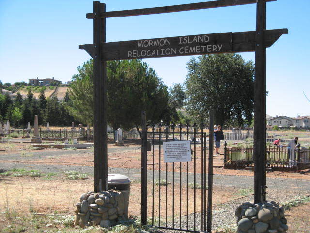
Mormon Island Relocation Cemetery was created in 1954 by the Army Corps of Engineers to replace the cemeteries at Salmon Falls, Negro Hill, Condemned Bar, McDowell's Hill, and Natural Dam in El Dorado County, the cemeteries at Dolton's Bar and Carrollton Bar in Placer County and Mormon Island in Sacramento County which were submerged below Folsom Lake when the Folsom Dam was built. Responsibility for the Mormon Island Cemetery was taken over by El Dorado County from the Army Corps of Engineers in October of 1954.
Five individual graves were also relocated from various locations to the new Mormon Island Cemetery. The earliest burial from any of these cemeteries could have been 1848, since several of these Mining Camps were first established in that year.
In 1996, remains from the Prairie City Cemetery in Sacramento County were interred after being discovered during the construction of the Prairie City Road on-ramp to Highway 50.
The cemetery is located off Blue Ravine/Green Valley Rd just east of the Sacramento/El Dorado County line. Although the cemetery is not full, it is being held in reserve for future relocation needs such as happened with the Praire City Cemetery.
Directions to get there:
Coming from Folsom on Bidwell Rd., take Blue Ravine Rd. east until you get to the El Dorado County line. Immediately turn right onto Shadowfax Rd. Go straight to the cemetery.
Coming from El Dorado Hills, take El Dorado Hills Blvd. north to Green Valley Rd. Turn left on Green Valley Rd and follow it to the Sacramento County line. Just as you get to the county line, turn left onto Shadowfax Rd. Follow the road to the cemetery.
Nearby cemeteries
El Dorado Hills, El Dorado County, California, USA
- Total memorials1
- Percent photographed100%

Represa, Sacramento County, California, USA
- Total memorials685
- Percent photographed80%
- Percent with GPS0%

Clarksville, El Dorado County, California, USA
- Total memorials126
- Percent photographed79%
- Percent with GPS28%

Clarksville, El Dorado County, California, USA
- Total memorials29
- Percent photographed59%
- Percent with GPS59%
- Added: 24 Jul 2007
- Find a Grave Cemetery ID: 2225207

Cemetery Photos
This is a carousel with slides. Use Next and Previous buttons to navigate, or jump to a slide with the slide dots. Use Escape keyboard button or the Close button to close the carousel.


Success
Uploading...
Waiting...
Failed
This photo was not uploaded because this cemetery already has 20 photos
This photo was not uploaded because you have already uploaded 5 photos to this cemetery
This photo was not uploaded because you have already uploaded 5 photos to this cemetery
Invalid File Type
Birth and death years unknown.
1 photo picked...
2 photos picked...
Uploading 1 Photo
Uploading 2 Photos
1 Photo Uploaded
2 Photos Uploaded
Size exceeded
Too many photos have been uploaded
"Unsupported file type"
• ##count## of 0 memorials with GPS displayed. Double click on map to view more.No cemeteries found