Saint Manvieu War Cemetery
Also known as Cimetière Britanique de Saint Manvieu-Norrey
Cheux, Departement du Calvados, Basse-Normandie, France
About
-
- Cemetery ID:
Members have Contributed
Advertisement
Photos


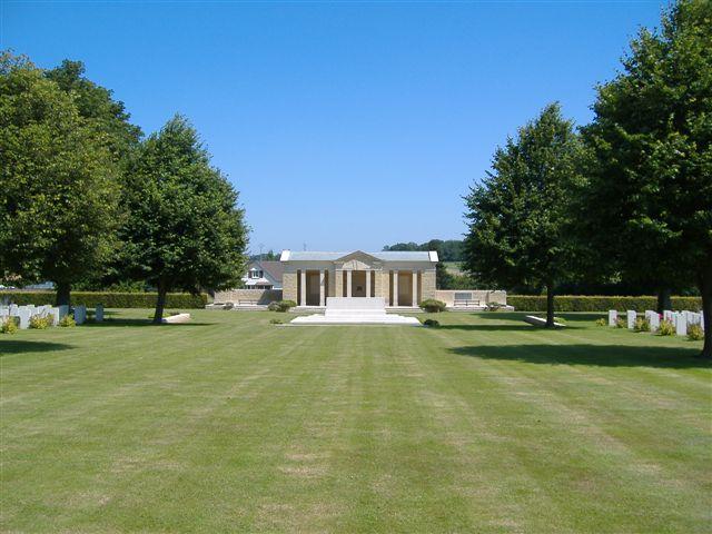
Cheux is a village 10 kilometres west of Caen. This cemetery is reached from Caen by taking route D9 westwards. After about 8 kilometres, the road by-passes St Manvieu village, while Cheux lies 2 kilometres to the left. You will find St Manvieu War Cemetery on the right hand side.
The Allied offensive in north-western Europe began with the Normandy landings of 6 June 1944. Those buried in St. Manvieu War Cemetery died for the most part in the fluctuating battles from mid June to the end of July 1944, in the region between Tilly-sur-Seulles and Caen.
The cemetery contains 1627 Commonwealth burials of the Second World War, 49 of them unidentified. There are also 555 German burials.
Nearby cemeteries

Mouen, Departement du Calvados, Basse-Normandie, France
- Total memorials1
- Percent photographed100%

Tourville-sur-Odon, Departement du Calvados, Basse-Normandie, France
- Total memorials6
- Percent photographed100%

Fontenay-le-Pesnel, Departement du Calvados, Basse-Normandie, France
- Total memorials510
- Percent photographed100%

Brouay, Departement du Calvados, Basse-Normandie, France
- Total memorials372
- Percent photographed100%
- Percent with GPS0%
- Added: 2 Jan 2007
- Find a Grave Cemetery ID: 2201772

Cemetery Photos
This is a carousel with slides. Use Next and Previous buttons to navigate, or jump to a slide with the slide dots. Use Escape keyboard button or the Close button to close the carousel.


Success
Uploading...
Waiting...
Failed
This photo was not uploaded because this cemetery already has 20 photos
This photo was not uploaded because you have already uploaded 5 photos to this cemetery
This photo was not uploaded because you have already uploaded 5 photos to this cemetery
Invalid File Type
Birth and death years unknown.
1 photo picked...
2 photos picked...
Uploading 1 Photo
Uploading 2 Photos
1 Photo Uploaded
2 Photos Uploaded
Size exceeded
Too many photos have been uploaded
"Unsupported file type"
• ##count## of 0 memorials with GPS displayed. Double click on map to view more.No cemeteries found