Eberhart Cemetery
Also known as Samuel Woods II Graveyard
Gainesville, Hall County, Georgia, USA
About
-
Get directions Eberhart Cemetery Road
Gainesville, Georgia 30507 United StatesCoordinates: 34.29324, -83.74835 - Cemetery ID:
Members have Contributed
Advertisement
Photos


Ann Kennedy Patton, contributor #48069415, provided the following information about the cemetery:
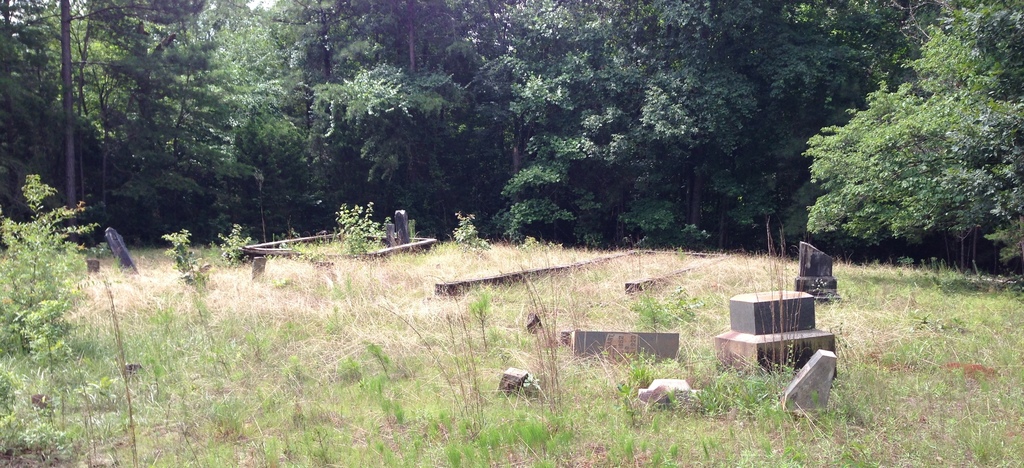
Samuel Woods married Elizabeth Patton, sister of William Patton. In 1793 brothers-in-law Samuel and William received a joint land grant of 580 acres in Franklin County, Georgia, for service in the Revolutionary War. In 1813, William sold his half-interest in the land (then situated in Jackson County) to Samuel. The land became part of Hall County when Hall was created in 1820. Samuel Woods willed the land to his son Robert; Robert sold it to Jacob Eberhart in 1823.
Directions: Take I-985 / US-23 / Lanier Pkwy to Athens Hwy. (US 129, GA-11) and, traveling away from downtown Gainesville, go to Gaines Mill Road. Turn left on Gaines Mill Road and go approximately 3 miles to Eberhart Cemetery Road. The cemetery will be about 1 mile away, on the left.
A list of graves (from a 1931 survey) and a layout of the cemetery are available at USGenNet.org/USA/GA/County/Hall.
Ann Kennedy Patton, contributor #48069415, provided the following information about the cemetery:
Samuel Woods married Elizabeth Patton, sister of William Patton. In 1793 brothers-in-law Samuel and William received a joint land grant of 580 acres in Franklin County, Georgia, for service in the Revolutionary War. In 1813, William sold his half-interest in the land (then situated in Jackson County) to Samuel. The land became part of Hall County when Hall was created in 1820. Samuel Woods willed the land to his son Robert; Robert sold it to Jacob Eberhart in 1823.
Directions: Take I-985 / US-23 / Lanier Pkwy to Athens Hwy. (US 129, GA-11) and, traveling away from downtown Gainesville, go to Gaines Mill Road. Turn left on Gaines Mill Road and go approximately 3 miles to Eberhart Cemetery Road. The cemetery will be about 1 mile away, on the left.
A list of graves (from a 1931 survey) and a layout of the cemetery are available at USGenNet.org/USA/GA/County/Hall.
Nearby cemeteries

Gainesville, Hall County, Georgia, USA
- Total memorials10
- Percent photographed100%
- Percent with GPS0%
Gainesville, Hall County, Georgia, USA
- Total memorials2
- Percent photographed0%
- Percent with GPS0%

Gainesville, Hall County, Georgia, USA
- Total memorials522
- Percent photographed95%
- Percent with GPS4%

Gainesville, Hall County, Georgia, USA
- Total memorials3
- Percent photographed100%
- Percent with GPS0%
- Added: 16 Apr 2012
- Find a Grave Cemetery ID: 2445672

Cemetery Photos
This is a carousel with slides. Use Next and Previous buttons to navigate, or jump to a slide with the slide dots. Use Escape keyboard button or the Close button to close the carousel.


Success
Uploading...
Waiting...
Failed
This photo was not uploaded because this cemetery already has 20 photos
This photo was not uploaded because you have already uploaded 5 photos to this cemetery
This photo was not uploaded because you have already uploaded 5 photos to this cemetery
Invalid File Type
Birth and death years unknown.
1 photo picked...
2 photos picked...
Uploading 1 Photo
Uploading 2 Photos
1 Photo Uploaded
2 Photos Uploaded
Size exceeded
Too many photos have been uploaded
"Unsupported file type"
• ##count## of 0 memorials with GPS displayed. Double click on map to view more.No cemeteries found