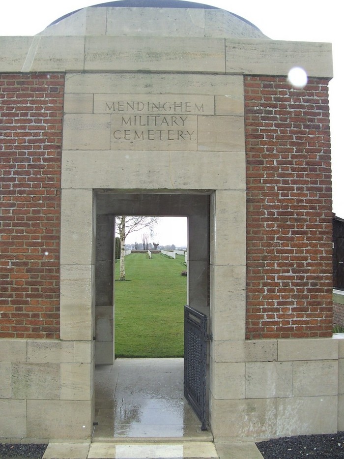
Mendinghem Military Cemetery
Proven, Arrondissement Ieper, West Flanders, Belgium
About
-
- Cemetery ID:
Members have Contributed
Advertisement
Photos


Location Information: Mendinghem Military Cemetery is located 17 km north west of Ieper town centre on the N308 connecting Ieper to Poperinge and on to Oost-Cappel. From Ieper town centre the Poperingseweg (N308), is reached via Elverdingsestraat then directly over two small roundabouts in the J. Capronstraat. The Poperingseweg is a continuation of the J. Capronstraat and begins after a prominent railway level crossing. On reaching the ring road of Poperinge R33 Europalaan, the left hand clockwise route circles the town of Poperinge and rejoins the N308 towards Oost-Cappel. 6.5 km after joining the N308 lies the village of Proven. The cemetery is located 500 metres beyond the village of Proven on the left hand side of the road (which at this point is called Roesbruggestraat).
Historical Information: Mendinghem, like Dozinghem and Bandaghem, were the popular names given by the troops to groups of casualty clearing stations posted to this area during the First World War. In July 1916, the 46th (1st/1st Wessex) Casualty Clearing Station was opened at Proven and this site was chosen for its cemetery. The first burials took place in August 1916. In July 1917, four further clearing stations arrived at Proven in readiness for the forthcoming Allied offensive on this front and three of them, the 46th, 12th and 64th, stayed until 1918. From May to July 1918, while the German offensive was at its height, field ambulances were posted at Proven. The cemetery was closed (except for one later burial) in September 1918. There are now 2,391 Commonwealth burials of the First World War in this cemetery and 52 German war graves. The cemetery was designed by Sir Reginald Blomfield.
No. of Identified Casualties: 2434
Nearby cemeteries
Proven, Arrondissement Ieper, West Flanders, Belgium
- Total memorials17
- Percent photographed76%
- Percent with GPS0%

Haringe, Arrondissement Ieper, West Flanders, Belgium
- Total memorials811
- Percent photographed60%
- Percent with GPS0%

Roesbrugge, Arrondissement Ieper, West Flanders, Belgium
- Total memorials3
- Percent photographed67%
- Percent with GPS0%

Krombeke, Arrondissement Ieper, West Flanders, Belgium
- Total memorials79
- Percent photographed95%
- Percent with GPS0%
- Added: 10 Jul 2003
- Find a Grave Cemetery ID: 1966581

Cemetery Photos
This is a carousel with slides. Use Next and Previous buttons to navigate, or jump to a slide with the slide dots. Use Escape keyboard button or the Close button to close the carousel.


Success
Uploading...
Waiting...
Failed
This photo was not uploaded because this cemetery already has 20 photos
This photo was not uploaded because you have already uploaded 5 photos to this cemetery
This photo was not uploaded because you have already uploaded 5 photos to this cemetery
Invalid File Type
Birth and death years unknown.
1 photo picked...
2 photos picked...
Uploading 1 Photo
Uploading 2 Photos
1 Photo Uploaded
2 Photos Uploaded
Size exceeded
Too many photos have been uploaded
"Unsupported file type"
• ##count## of 0 memorials with GPS displayed. Double click on map to view more.No cemeteries found