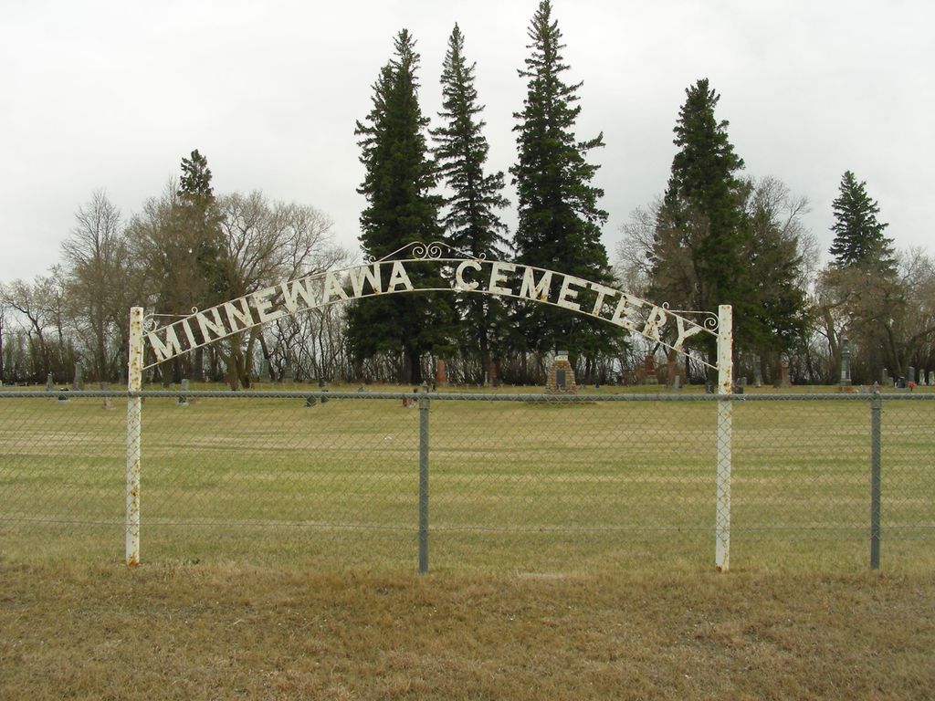
Minnewawa Cemetery
Nesbitt, Brandon Census Division, Manitoba, Canada
About
-
Get directions 108072 Red Coat Trail
(aka Provincial Highway 2)
Nebitt, Oakland-Wawanesa, Manitoba
R0K 1P0 CanadaCoordinates: 49.59097, -99.92486 - www.oakland-wawanesa.ca/p/cemeteries
- [email protected]
- +1-204-824-2666
-
Office Address
Municipality of Oakland-Wawanesa
106 Fourth Street
PO Box 278
Wawanesa, Oakland-Wawanesa, Manitoba
R0K 2G0 Canada - Cemetery ID:
-
Additional information
Located in the south side of and adjacent to the Red Coat Trail (Provincial Highway 2), about 0.5 miles (0.8 km) west of Minnewawa Road (aka Provincial Road 108W)
There is no network of improved roadways providing vehicular access to the grounds.
The cemetery is managed by a local committee, whose current contact information is available on the Municipality of Oakland-Wawanesa website [2024/03].
Members have Contributed
Advertisement
Photos


In the year of 1881, when settlers started to come into the Minnewawa district, there were no railroads or highways and very few houses. There was only a prairie trail from the Turtle Mountains to Brandon. The dwellings were either log or sod houses. In the summer, Indians travelled in bands.
The prairie trail we travelled is now replaced by the No. 10 Highway. In those early days, the nearest town was Brandon, and most people had to walk to get there, a distance of twenty miles. But people were very kind and would bring anything you wanted from Brandon.
The mail came around by Carroll the first year and after that, it came to Minnewawa Post Office which was in the house of Mr. and Mrs. Young. The mail was carried by horse and buckboard in the summer and by cutter in the winter. Mr. Crompton was one of the men who carried the mail for some time.
In 1884, Mr. McMurchie formed a school district and Minnewawa School was built the following year. Mr. Harding was one of the men who helped draw the lumber from Brandon. He was always ready to lend a helping hand be it threshing or any other kind of work.
The first church service held in the Berbank district was at the home of Mr. and Mrs. William English. After Minnewawa School was built, the services were held in it.
We would also mention Minnewawa Cemetery which came into being through the efforts of Mr. McMurchie.
Gradually more and more people came west to settle and faith in the country increased, although some thought it should never have been taken from the Indians.
The coming of the railroad made life more bearable as the farmers did not have to draw their grain to Brandon. (Compiled by Mr. Hugh Munn and Mrs. Dalton Munn)
(Source: Oakland Echoes 1879-1970, pp 120f [1970; Adapted])
~~~~~~~~~~
Established in 1889, after a meeting was called in the Minnewawa school house by John Young and P. McMurchie on November 1, 1889, to organize a company with a view to having a suitable place to inter the dead.
(Source: Manitoba Genealogical Society [Adapted])
The cemetery, established in 1889 contains a monument commemorating the pioneers of the communities of Minnewawa (1885-1957), Nesbitt (1893-1968), Chesley (1882-1966), Bertha (1896-1961), Riverbank (1886-1953), and Delton (1883-1967).
At one time, the millstone from Gregory's Mill was displayed by the monument.
(Source: Manitoba Historical Society [Adapted])
~~~~~~~~~~
Dominion Land Survey coordinates: LSD15-24-07-19-W1
In the Municipality of Oakland-Wawanesa
~~~~~~~~~~
As noted above, a part of the community's story, and those of its inhabitants, from the early days of European settlement through roughly 1970 is told in the volume "Oakland Echoes 1879-1970", especially on the cited pages. A free digital version of this and many other Manitoba local history books can be found online in the University of Manitoba Digital Collections. There is also a list of such books organized by district and town name on the Manitoba Historical Society's website on their page entitled "Finding Aid: Manitoba Local History Books".
A list of burials in this cemetery is available from the Manitoba Genealogical Society (reference #0087), transcribed by a member or members in 1981. Also available to MGS members is a searchable online database named the "MGS Manitoba Name Index" (or MANI). Some additional information is contained in the 1996 MGS publication "Carved in Stone: Manitoba Cemeteries and Burial Sites" (revised edition, Special Projects Publication, 106 pages).
Nearby cemeteries

Carroll, Brandon Census Division, Manitoba, Canada
- Total memorials355
- Percent photographed95%
- Percent with GPS6%

Nesbitt, Brandon Census Division, Manitoba, Canada
- Total memorials37
- Percent photographed100%
- Percent with GPS0%

Wawanesa, Brandon Census Division, Manitoba, Canada
- Total memorials18
- Percent photographed94%
- Percent with GPS0%

Rounthwaite, Brandon Census Division, Manitoba, Canada
- Total memorials86
- Percent photographed94%
- Percent with GPS2%
- Added: 3 May 2010
- Find a Grave Cemetery ID: 2352917

Cemetery Photos
This is a carousel with slides. Use Next and Previous buttons to navigate, or jump to a slide with the slide dots. Use Escape keyboard button or the Close button to close the carousel.


Success
Uploading...
Waiting...
Failed
This photo was not uploaded because this cemetery already has 20 photos
This photo was not uploaded because you have already uploaded 5 photos to this cemetery
This photo was not uploaded because you have already uploaded 5 photos to this cemetery
Invalid File Type
Birth and death years unknown.
1 photo picked...
2 photos picked...
Uploading 1 Photo
Uploading 2 Photos
1 Photo Uploaded
2 Photos Uploaded
Size exceeded
Too many photos have been uploaded
"Unsupported file type"
• ##count## of 0 memorials with GPS displayed. Double click on map to view more.No cemeteries found