Union Cemetery
Also known as New Union Cemetery , Old Union Cemetery
Columbus, Franklin County, Ohio, USA
About
-
Get directions 3349 Olentangy River Road
Columbus, Ohio 43212 United StatesCoordinates: 40.02772, -83.02890 - www.unioncemeterycolumbus.com
- 614-267-5471
- Cemetery ID:
Members have Contributed
Advertisement
Photos


Please note that Amaranth Abbey Mausoleum is a separate listing, although the Abbey and burial records are now maintained by Union Cemetery.
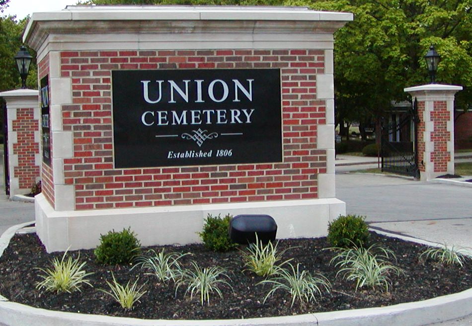
The cemetery is operated by the Union Cemetery Association, which was created in 1878. The cemetery is managed as a single entity with two physically separate components: the east cemetery (the old cemetery) and the west cemetery (new cemetery or 1946 addition). The original cemetery lies on the east side of Olentangy River Road on the northeast corner of its intersection with West Dodridge Street. In 1946, the Union Cemetery Association acquired an additional 75 acres on the west side of Olentangy River Road with its southern boundary about 900 feet north of the northern boundary of the east cemetery. The cemetery began as a burial site for the Hess family and other families in 1806. In 1847, Union Cemetery was established on land purchased from the Hess family. The cemetery has a total size of 128 acres. The east cemetery has multiple entrances along Olentangy River Road and along West Dodridge Road. The center of the east cemetery is at latitude 40° 01' 14.4"N and longitude 83° 01' 21.1"W. The main entrance to the west cemetery is located at latitude 40° 01' 38.9"N and longitude 83° 01' 41.4"W
The cemetery is located in Clinton Township, Franklin County, Ohio, and is # 3470 (New Union Cemetery / Union Cemetery) and # 3469 (Old Union Cemetery / Union Cemetery) in "Ohio Cemeteries 1803-2003", compiled by the Ohio Genealogical Society.
The cemetery is registered with the Ohio Division of Real Estate and Professional Licensing (ODRE) as being operated by the Union Cemetery Association with registration license number CRC.0000980965.
The U.S. Geological Survey (USGS) Geographic Names Information System (GNIS) feature ID for the east cemetery (old cemetery) is 1047276 (Union Cemetery).
The U.S. Geological Survey (USGS) Geographic Names Information System (GNIS) feature ID for the west cemetery (new cemetery) is 1047277 (Union Cemetery).
Please note that Amaranth Abbey Mausoleum is a separate listing, although the Abbey and burial records are now maintained by Union Cemetery.
The cemetery is operated by the Union Cemetery Association, which was created in 1878. The cemetery is managed as a single entity with two physically separate components: the east cemetery (the old cemetery) and the west cemetery (new cemetery or 1946 addition). The original cemetery lies on the east side of Olentangy River Road on the northeast corner of its intersection with West Dodridge Street. In 1946, the Union Cemetery Association acquired an additional 75 acres on the west side of Olentangy River Road with its southern boundary about 900 feet north of the northern boundary of the east cemetery. The cemetery began as a burial site for the Hess family and other families in 1806. In 1847, Union Cemetery was established on land purchased from the Hess family. The cemetery has a total size of 128 acres. The east cemetery has multiple entrances along Olentangy River Road and along West Dodridge Road. The center of the east cemetery is at latitude 40° 01' 14.4"N and longitude 83° 01' 21.1"W. The main entrance to the west cemetery is located at latitude 40° 01' 38.9"N and longitude 83° 01' 41.4"W
The cemetery is located in Clinton Township, Franklin County, Ohio, and is # 3470 (New Union Cemetery / Union Cemetery) and # 3469 (Old Union Cemetery / Union Cemetery) in "Ohio Cemeteries 1803-2003", compiled by the Ohio Genealogical Society.
The cemetery is registered with the Ohio Division of Real Estate and Professional Licensing (ODRE) as being operated by the Union Cemetery Association with registration license number CRC.0000980965.
The U.S. Geological Survey (USGS) Geographic Names Information System (GNIS) feature ID for the east cemetery (old cemetery) is 1047276 (Union Cemetery).
The U.S. Geological Survey (USGS) Geographic Names Information System (GNIS) feature ID for the west cemetery (new cemetery) is 1047277 (Union Cemetery).
Nearby cemeteries
Columbus, Franklin County, Ohio, USA
- Total memorials42
- Percent photographed2%
- Percent with GPS0%

Columbus, Franklin County, Ohio, USA
- Total memorials688
- Percent photographed95%
- Percent with GPS1%

Clinton, Franklin County, Ohio, USA
- Total memorials39
- Percent photographed0%
- Percent with GPS0%

Columbus, Franklin County, Ohio, USA
- Total memorials65
- Percent photographed55%
- Percent with GPS37%
- Added: 1 Jan 2000
- Find a Grave Cemetery ID: 43840

Cemetery Photos
This is a carousel with slides. Use Next and Previous buttons to navigate, or jump to a slide with the slide dots. Use Escape keyboard button or the Close button to close the carousel.


Success
Uploading...
Waiting...
Failed
This photo was not uploaded because this cemetery already has 20 photos
This photo was not uploaded because you have already uploaded 5 photos to this cemetery
This photo was not uploaded because you have already uploaded 5 photos to this cemetery
Invalid File Type
Birth and death years unknown.
1 photo picked...
2 photos picked...
Uploading 1 Photo
Uploading 2 Photos
1 Photo Uploaded
2 Photos Uploaded
Size exceeded
Too many photos have been uploaded
"Unsupported file type"
• ##count## of 0 memorials with GPS displayed. Double click on map to view more.No cemeteries found