Chandler Cemetery
Stanbridge East, Estrie Region, Quebec, Canada
About
-
Get directions Chemin North
Stanbridge East, Monteregie Region, Quebec J0J 2H0 CanadaCoordinates: 45.14441, -72.91689 - Cemetery ID:
Members have Contributed
Advertisement
Photos

Municipality: Stanbridge East
MRC: Brome-Missisquoi
Administrative Region: Montérégie
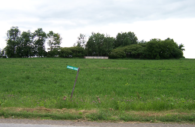
In field on North Rd., Stanbridge East.
Legal Owner: Unknown (prob. private property)
Custodian: Missisquoi Historical Society Cemetery Committee
Governance Structure: Basic maintenance performed by MHS, which has taken this cemetery under its wing.
Contact Info: Missisquoi Historical Society, 2 River St., Stanbridge East, QC J0J 2H0 (450) 248-3153.
Date of Earlist Burial: 1824
Date of most Recent Burial: 1871
Cemetery Status: Inactive
Cemetery Size: 20 X 80
Number of Burials: 80
Please email Nancy if you are connected to this cemetery
[email protected]
When in Stanbridge East at the intersection of RTE 202, & Rue River, turn onto Rue River and drive for 750 meters to the intersection of Rue Maple. Turn right and head north on Rue Maple, and drive for 350 meters to the intersection of Chemin de Riceburg. (At that point Rue Maple becomes Chemin North). Continue straight north on Chemin North and drive for 2.2 km. It will be on your left about 110 meters from the road.
Municipality: Stanbridge East
MRC: Brome-Missisquoi
Administrative Region: Montérégie
In field on North Rd., Stanbridge East.
Legal Owner: Unknown (prob. private property)
Custodian: Missisquoi Historical Society Cemetery Committee
Governance Structure: Basic maintenance performed by MHS, which has taken this cemetery under its wing.
Contact Info: Missisquoi Historical Society, 2 River St., Stanbridge East, QC J0J 2H0 (450) 248-3153.
Date of Earlist Burial: 1824
Date of most Recent Burial: 1871
Cemetery Status: Inactive
Cemetery Size: 20 X 80
Number of Burials: 80
Please email Nancy if you are connected to this cemetery
[email protected]
When in Stanbridge East at the intersection of RTE 202, & Rue River, turn onto Rue River and drive for 750 meters to the intersection of Rue Maple. Turn right and head north on Rue Maple, and drive for 350 meters to the intersection of Chemin de Riceburg. (At that point Rue Maple becomes Chemin North). Continue straight north on Chemin North and drive for 2.2 km. It will be on your left about 110 meters from the road.
Nearby cemeteries

Stanbridge East, Estrie Region, Quebec, Canada
- Total memorials72
- Percent photographed99%
- Percent with GPS0%

Stanbridge East, Estrie Region, Quebec, Canada
- Total memorials48
- Percent photographed92%
- Percent with GPS19%

Stanbridge East, Estrie Region, Quebec, Canada
- Total memorials173
- Percent photographed97%
- Percent with GPS0%

Saint-Ignace-de-Stanbridge, Estrie Region, Quebec, Canada
- Total memorials184
- Percent photographed96%
- Percent with GPS0%
- Added: 12 Feb 2012
- Find a Grave Cemetery ID: 2437308

Cemetery Photos
This is a carousel with slides. Use Next and Previous buttons to navigate, or jump to a slide with the slide dots. Use Escape keyboard button or the Close button to close the carousel.

Success
Uploading...
Waiting...
Failed
This photo was not uploaded because this cemetery already has 20 photos
This photo was not uploaded because you have already uploaded 5 photos to this cemetery
This photo was not uploaded because you have already uploaded 5 photos to this cemetery
Invalid File Type
Birth and death years unknown.
1 photo picked...
2 photos picked...
Uploading 1 Photo
Uploading 2 Photos
1 Photo Uploaded
2 Photos Uploaded
Size exceeded
Too many photos have been uploaded
"Unsupported file type"
• ##count## of 0 memorials with GPS displayed. Double click on map to view more.No cemeteries found