Hobsonville Church and Settlers' Cemetery
Also known as Hobsonville Church Cemetery
Hobsonville, Auckland Council, Auckland, New Zealand
About
-
Get directions 1 Scott Road
Hobsonville, Auckland Council, Auckland 0618 New ZealandCoordinates: -36.80005, 174.65518 - hobsonvillechurch.co.nz
- Cemetery ID:
Members have Contributed
Advertisement
Photos


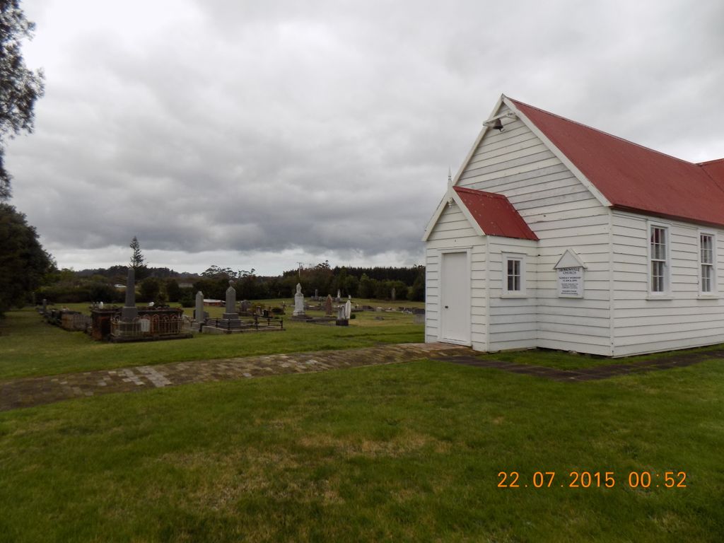
The cemetery sits in Hobsonville which began its European beginnings as a small, isolated settlement at the head of the Waitemata Harbour. It is named after the first Governor of New Zealand, Captain William Hobson, Royal Navy. The area has a history of brick and pottery making. It is also adjacent to the former Royal New Zealand Air Force base of Hobsonville (est. 1929). The surrounds are now the new Auckland suburb of Hobsonville Point.
The church was built on land donated by one of the first settlers of Hobsonville, Mr. Rice Owen Clark II. Mr Clark bought the land for use by the Presbyterian Church in 1875. He also donated to the church building fund using money earned from transporting goods for other settlers. It is primarily built of Kauri. The historic church is listed on the New Zealand Heritage list (#9796).
The church was also a meeting place and school along with the adjacent burial grounds. The last church service was conducted in 1967. At one stage it was used as a Scout Hall. It is now used for wedding ceremonies and can be hired for other events.
The first recorded burial is in 1875. All five original trustees of the land in 1877 are buried in the cemetery – Rice Clark II, Joshua Carder, Joshua Ockelston, Thomas Scott, and William Sinton. Other prominent settler families are also buried there – Anderson, Boyd, Luckens, Midgley, Williams and Wiseley. All these families have local roads named after them. The cemetery also contains several miltiary personnel and their families.
Visiting the cemetery is easy with SH18 running close by and ferries and buses servicing the area. The road trip from the Auckland CBD takes around 20 minutes. The cemetery is flat allowing ease of access through the main gates.
The Hobsonville Church and Settlers' Cemetery is in the trusteeship of The Hobsonville Church and Settlers Cemetery Preservation Society Incorporated.
Nearby cemeteries

Auckland, Auckland Council, Auckland, New Zealand
- Total memorials15k+
- Percent photographed82%
- Percent with GPS28%

Birkenhead, Auckland Council, Auckland, New Zealand
- Total memorials5k+
- Percent photographed90%
- Percent with GPS50%

Birkenhead, Auckland Council, Auckland, New Zealand
- Total memorials734
- Percent photographed70%
- Percent with GPS23%

Silverdale, Auckland Council, Auckland, New Zealand
- Total memorials352
- Percent photographed85%
- Percent with GPS15%
- Added: 5 Sep 2009
- Find a Grave Cemetery ID: 2321849

Cemetery Photos
This is a carousel with slides. Use Next and Previous buttons to navigate, or jump to a slide with the slide dots. Use Escape keyboard button or the Close button to close the carousel.


Success
Uploading...
Waiting...
Failed
This photo was not uploaded because this cemetery already has 20 photos
This photo was not uploaded because you have already uploaded 5 photos to this cemetery
This photo was not uploaded because you have already uploaded 5 photos to this cemetery
Invalid File Type
Birth and death years unknown.
1 photo picked...
2 photos picked...
Uploading 1 Photo
Uploading 2 Photos
1 Photo Uploaded
2 Photos Uploaded
Size exceeded
Too many photos have been uploaded
"Unsupported file type"
• ##count## of 0 memorials with GPS displayed. Double click on map to view more.No cemeteries found